

Alabama map
Madison County map
About 423,355 people live here (Census Bureau, 2024 estimate). The sheet's index lists 7 streets; Research Park Boulevard, Rideout Road Northwest and Memorial Parkway Northwest cross the most grid squares. Things to do inside the boundary: U.S. Space & Rocket Center.
Open the map (PDF, US Letter)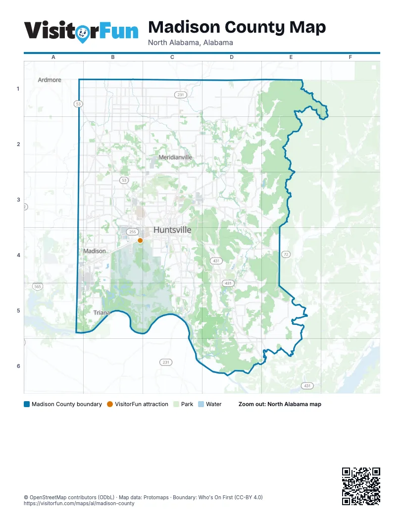
Maps inside Madison County
1 map inside, from the street map of Madison County down.
Street index of Madison County
Each street on the sheet and the grid squares it crosses.
- Research Park Blvd NorthwestB3
- Research Park BoulevardB3, B4
- Research Park Boulevard NorthwestB3
- Rideout Road NorthwestB3, B4
- Memorial Parkway NorthwestC3, C4
- Rideout RoadB4
- Memorial Parkway SouthwestC4
Things to do on the Madison County map
Places on the map
- Aldridge Creek Greenway
- Alum Hollow Land Trust
- Ashley
- Ashley Greens
- Beverly's Place
- Big Cove Creek Greenway
- Blackwell Swamp
- Blevins Gap Preserve
- Bluewater Huntsville Quarry
- Bradford Farms
- Brahan Spring Park
- Cavalry Hill
- Chadrick
- Chickasaw Estates
- Clifts Cove
- Colonial Pointe
- Crestview Estates
- Crown Pointe
- Cummings Research Park
- Ditto Landing
- Dunlop Tire
- Dyas Swamp
- Edgewater
- Fowler Creek
- Foxfield
- Franklin Station
- Greenlawn Plantation
- Gurley
- Gurley Quarry
- Harvest
- Hays Nature Preserve
- Hazel Green
- Heatherwood
- Heights at Town Madison
- Heritage Plantation
- Highland Lakes
- Hillside Golf Course
- Hobbs Island
- Huntsville
- Huntsville Botanical Gardens
Next to Madison County
- Ardmore
© OpenStreetMap contributors (ODbL) · Map data: Protomaps · Boundary: Who's On First (CC-BY 4.0)