

California map
Shasta Cascade map
The sheet's index lists 6 highways; I-5, CA 99 and CA 44 cross the most grid squares. Things to do inside the boundary: Bricks & Minifigs Redding, Gaumer's Jewelry & Museum and Lake Shasta Caverns. Also on it: Alturas, Anderson and Chester.
Open the map (PDF, US Letter)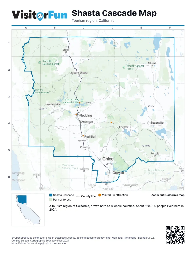
Highway index of Shasta Cascade
Each highway on the sheet and the grid squares it crosses.
- I-5B1, C1, C2, C3, C4, C5
- CA 44C4
- CA 70D6
- CA 99C5, D5, D6
- CA 149D6
- CA 299C4
Things to do on the Shasta Cascade map
Places on the map
- Alturas
- Anderson
- Chester
- Chico
- Corning
- Mount Shasta
- Oroville
- Portola
- Red Bluff
- Redding
- Susanville
- Weaverville
- Yreka
Next to Shasta Cascade
- Central Valley map
- Gold Country map
- North Coast map
- Reno-Tahoe Territory
- Southern Oregon
© OpenStreetMap contributors, Open Database License, openstreetmap.org/copyright · Map data: Protomaps · Boundary: U.S. Census Bureau, Cartographic Boundary Files 2024