

Visitor map
Door County Map
The visitor map Door County, Wisconsin publishes as a PDF. Open or print it, then see the Door County listing and the rest of Wisconsin below.
Open the map (PDF)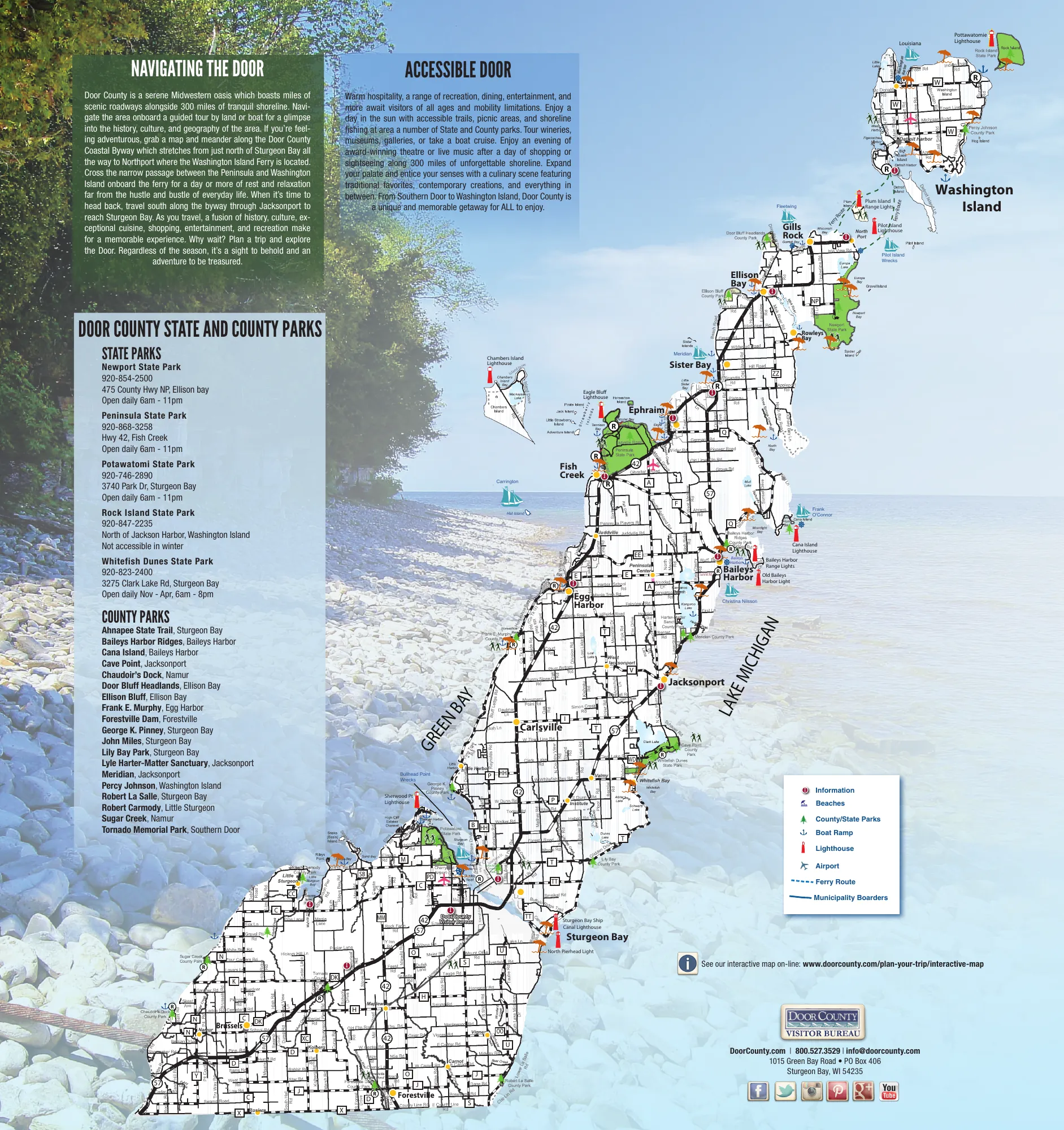
About this map
The Door County Visitor Bureau's map of the Door Peninsula in Wisconsin, between Green Bay and Lake Michigan, from Brussels and Forestville in the south to Gills Rock and Washington Island in the north. It marks the towns, roads, state and county parks, lighthouses, beaches, boat ramps, the airport and the ferry route.
Beside the map are the five state parks with their addresses, phone numbers and opening hours, and the county parks by town. The text describes the Door County Coastal Byway, which runs from just north of Sturgeon Bay to Northport, where the Washington Island ferry leaves. The file is from 2014.
State parks on the map
- Newport State Park, Ellison Bay
- Peninsula State Park, Fish Creek
- Potawatomi State Park, Sturgeon Bay
- Rock Island State Park, north of Jackson Harbor on Washington Island
- Whitefish Dunes State Park, Sturgeon Bay
Towns on the map
- Sturgeon Bay
- Egg Harbor
- Fish Creek
- Ephraim
- Sister Bay
- Ellison Bay
- Gills Rock
- Baileys Harbor
- Jacksonport
- Carlsville
- Forestville
- Brussels
- Washington Island















