

Florida map
Brevard County map
About 658,447 people live here (Census Bureau, 2024 estimate). The sheet's index lists 5 streets; Challenger Memorial Parkway, Bennett Causeway and Beachline Expressway cross the most grid squares. Things to do inside the boundary: Kennedy Space Center Visitor Complex.
Open the map (PDF, US Letter)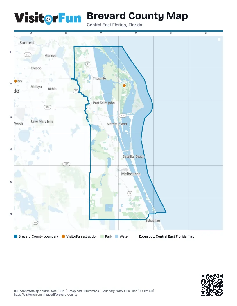
Street index of Brevard County
Each street on the sheet and the grid squares it crosses.
- Challenger Memorial ParkwayC2, C3
- Beachline ExpresswayC3
- Bennett CausewayC3, D3
- Astronaut BoulevardD3
- Pineda CausewayD4
Things to do on the Brevard County map
Places on the map
- Adamson Creek
- Aquarina Country Club
- Banana Creek
- Baytree National
- Bella Vista Nursery
- Blue Origin
- Bowe Gardens
- Brevard County
- Bridgewater At Viera
- Broadaxe Creek
- Buck Lake Conservation Area
- Canaveral Marshes Conservation Area
- Cape Canaveral
- Cape Canaveral Space Force Station
- Chain of Lakes Park
- Charolais Estates
- Cochran Cove
- Cocoa
- Cocoa Beach
- Cocoa Beach Country Club
- Cocoa West
- Crossmolina
- Cruickshank Trail
- Cypress Bay
- Del Webb at Viera
- Duran Golf Club
- Enchanted Forest Sanctuary
- Fairway Lakes at Duran
- Far Reach Ranch Conservation Easement
- Farmton Brevard Mitigation Bank
- Fox Lake
- Fred Poppe Regional Park
- FSA 5
- Future Brookshire Subdivision
- Gardens at Waterstone
- Goodwin Lake
- Grant Flatwoods Sanctuary
- Grant-Valkaria
- Halfway Lake
- Hammock Landing
Next to Brevard County
- Alafaya
- Bithlo
- Geneva
- Lake Mary Jane
- Midway
- Oviedo
- Saint Cloud
- Sanford
- Sebastian
- University
- Winter Springs
© OpenStreetMap contributors (ODbL) · Map data: Protomaps · Boundary: Who's On First (CC-BY 4.0)