

Florida map
Central East Florida map
The sheet's index lists 19 highways; I-95, US 17 and SR 70 cross the most grid squares. Things to do inside the boundary: Blue Spring State Park, Cape Canaveral Space Force Museum and Daytona International Speedway. Also on it: Daytona Beach, DeLand and Deltona.
Open the map (PDF, US Letter)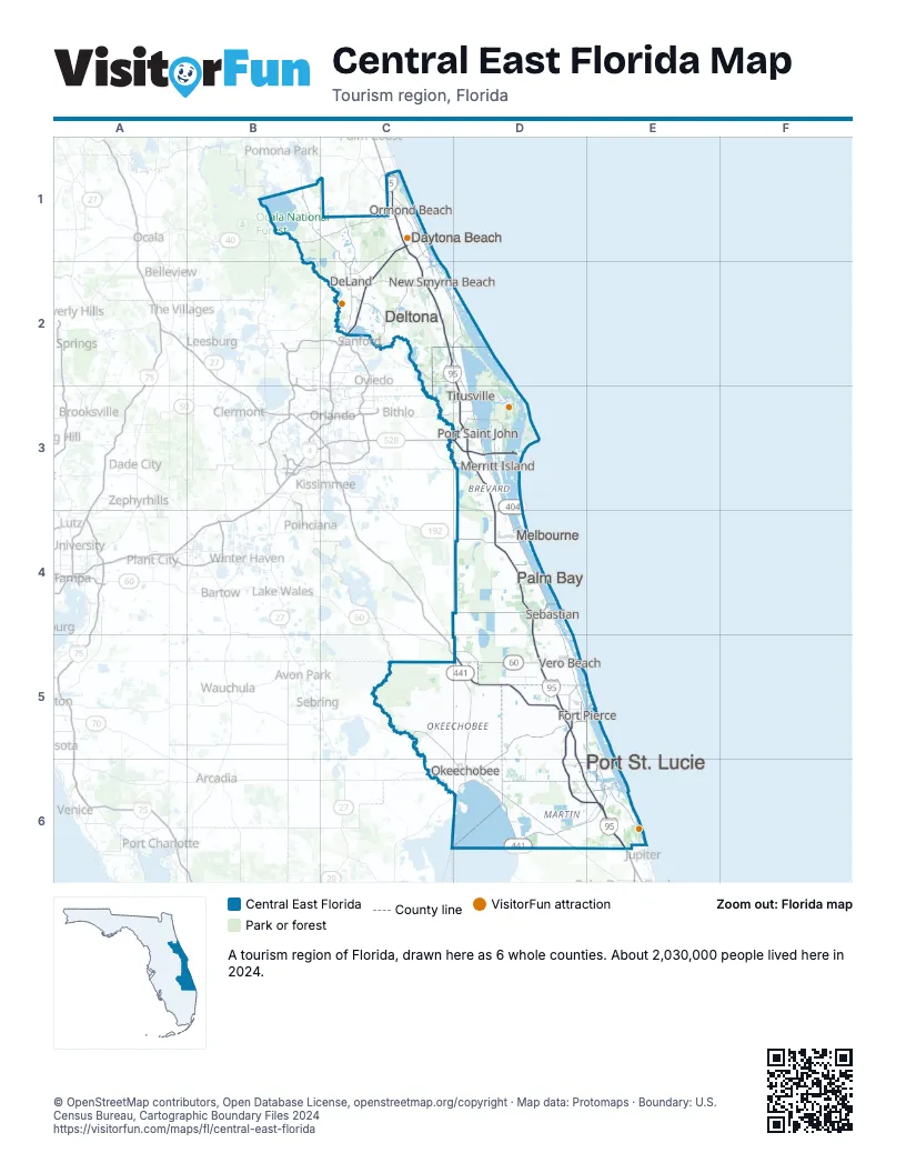
Highway index of Central East Florida
Each highway on the sheet and the grid squares it crosses.
- I-4C1, C2
- I-95C1, C2, D2, D3, D4, D5, D6, E6
- US 17B1, C1, C2
- US 92C2
- US 98D6
- US 192D4
- US 441D5, D6
- SR 15AC2
- SR 40B1, C1
- SR 50C3, D3
- SR 60D5
- SR 70C6, D5, D6
- SR 400C1
- SR 401D3
- SR 404D3
- SR 407C3, D3
- SR 472C2
- SR 528D3
- SR 710D6
Things to do on the Central East Florida map
- Blue Spring State Park
- Cape Canaveral Space Force Museum
- Daytona International Speedway
- De Leon Springs State Park
- Halifax Historical Museum
- Heathcote Botanical Gardens
- Kennedy Space Center Visitor Complex
- Marine Science Center
- Mary McLeod Bethune Home
- Melbourne Square
- Motorsports Hall of Fame of America
- PonTiki Boat Cruises
- Space View Park
- Volusia Mall
Places on the map
- Daytona Beach
- DeLand
- Deltona
- Fort Pierce
- Melbourne
- Merritt Island
- New Smyrna Beach
- Okeechobee
- Ormond Beach
- Palm Bay
- Port Saint John
- Port St. Lucie
- Sebastian
- Titusville
- Vero Beach
Next to Central East Florida
- Central Florida map
- Northeast Florida map
- Southeast Florida
- Southwest Florida map
© OpenStreetMap contributors, Open Database License, openstreetmap.org/copyright · Map data: Protomaps · Boundary: U.S. Census Bureau, Cartographic Boundary Files 2024