

Hawaii map
Honolulu County map
About 998,747 people live here (Census Bureau, 2024 estimate). The sheet's index lists 8 streets; Lunalilo Freeway, Queen Liliʻuokalani Freeway and John A. Burns Freeway cross the most grid squares. Things to do inside the boundary: Ala Moana Center, Aloha Tower and Banzai Pipeline.
Open the map (PDF, US Letter)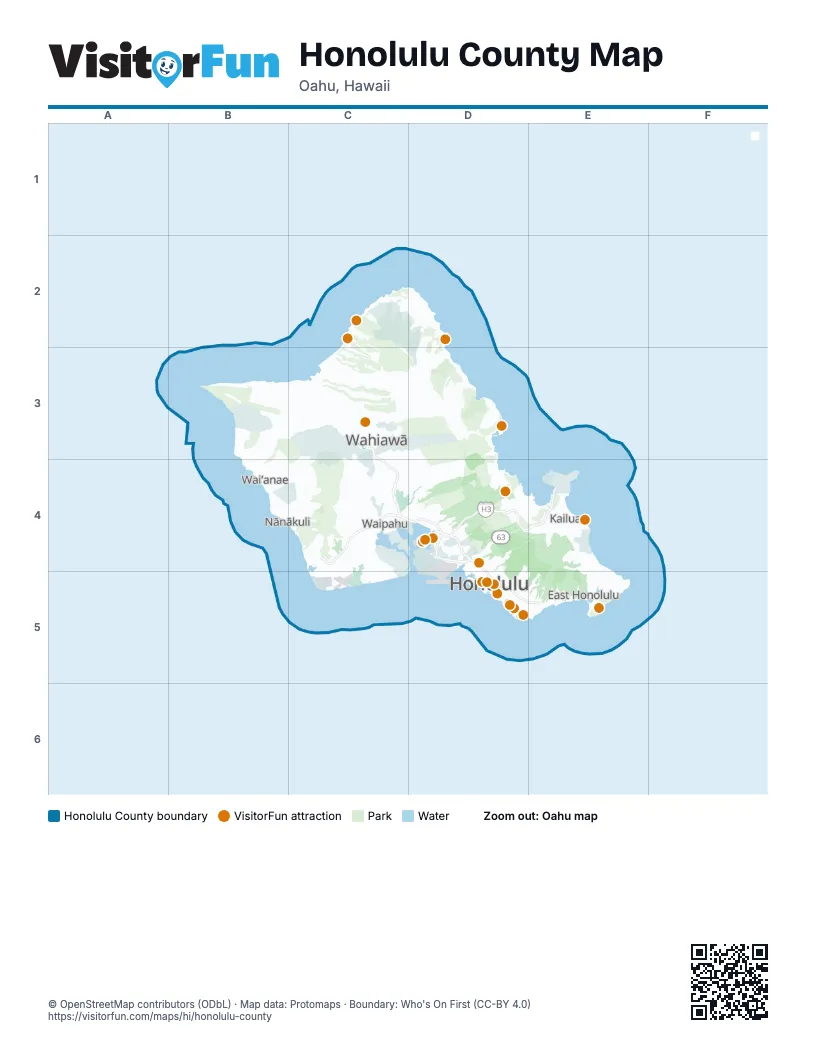
Street index of Honolulu County
Each street on the sheet and the grid squares it crosses.
- Farrington HighwayC4
- Queen Liliʻuokalani FreewayC4, D4
- Queen Liliuokalani FreewayC4
- Veteran's Memorial FreewayC4
- Interstate H-1D4
- John A. Burns FreewayD4, E4
- Lunalilo FreewayD4, D5, E5
- Moanalua FreewayD4
Things to do on the Honolulu County map
- Ala Moana Center
- Aloha Tower
- Banzai Pipeline
- Battleship Missouri Memorial
- Bishop Museum
- Byodo-In Temple
- Diamond Head State Monument
- Dole Plantation
- Hanauma Bay Nature Preserve
- Honolulu Museum of Art
- Honolulu Zoo
- ʻIolani Palace
- International Market Place
- Kualoa Ranch
- Lanikai Beach
- Pearl Harbor National Memorial
- Polynesian Cultural Center
- USS Arizona Memorial
- Waikiki Beach
- Waimea Bay
Places on the map
- ‘Āina Haina
- AES West Oahu Solar Hybrid
- Ahua Reef
- Ahuimanu
- Ahupuaʻa ʻO Kahana State Park
- Aiea
- Ala Moana Beach
- Ala Wai Canal
- Ala Wai Golf Course
- Aliamanu Military Reservation
- Aston at the Waikiki Banyan
- Campbell Industrial Park
- Capitol Place
- Championship Course
- Coral Creek Golf Course
- Daniel K. Inouye International Airport
- Diamond Head
- Diamond Head State Monument
- Earhart Villiage
- East Honolulu
- East Kapolei
- East Loch
- Ewa Beach Golf Club
- Ewa Forest Reserve
- Ewa Villages Golf Course
- Fort Shafter
- Hahaione Valley
- Haiku Hawaiian Home Land
- Halawa
- Halawa Quarry
- Hale Na Koa II
- Haleiwa
- Hanauma Bay State Park
- Hauula
- Hauula Forest Reserve
- Hawaii Country Club
- Hawaii Kai
- Hawaii Kai Marina
- Hawaii Kai Ridge & Cove
- Hawaii Memorial Park Cemetary
© OpenStreetMap contributors (ODbL) · Map data: Protomaps · Boundary: Who's On First (CC-BY 4.0)