

Indiana road map
Indiana's Historic Pathways map
Indiana's Historic Pathways has been a National Scenic Byway since 2009, named for its historic qualities: about 239 miles in Indiana. It meets 39 highways, among them I-64, I-65 and I-69. Towns along it: Jeffersonville, New Albany and Seymour.
Open the map (PDF, US Letter)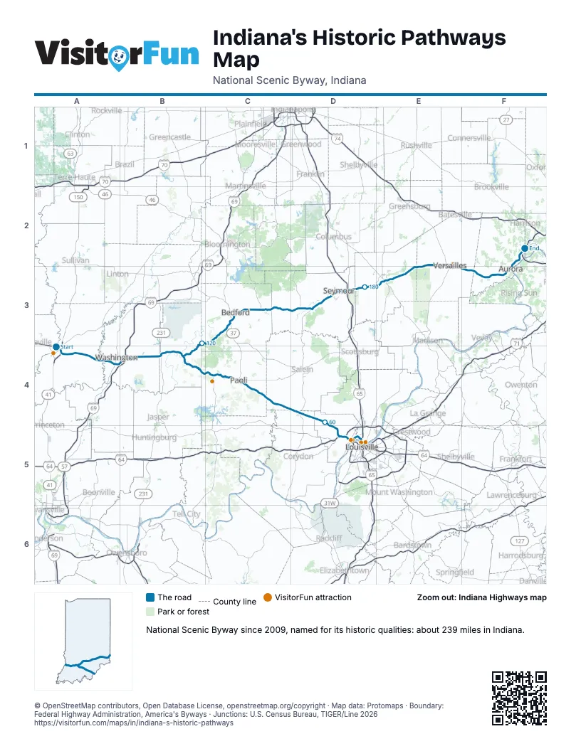
Highways it meets
Each highway it meets and the grid squares where they meet.
- US 41A4
- US 150A4
- IN 61A4
- IN 67A4
- US 50A4
- IN 550A4
- IN 241A4
- IN 57A4
- IN 257B4
- I-69B4
- US 231B4
- IN 450B4
- IN 111D5
- I-64D5
- IN 62D5
- US 335D4
- IN 355D4
- IN 335D4
- IN 135D4
- IN 66C4
- IN 56C4
- IN 37C4
- IN 650B4
- US 50EC3
- IN 446C3
- IN 235D3
- IN 11D3
- I-65D3
- US 31D3
- IN 3E3
- IN 7E3
- US 421E2
- IN 129E3
- IN 101F3
- IN 262F3
- IN 350F3
- IN 148F2
- IN 48F2
- IN 1F2
Towns along Indiana's Historic Pathways
In mile order, with the grid square of each.
- Vincennesmile 0, A4
- Washingtonmile 19, A4
- Montgomerymile 28, B4
- Cannelburgmile 32, B4
- Loogooteemile 37, B4
- Shoalsmile 44, B4
- Clarksvillemile 45, D5
- Jeffersonvillemile 45, D5
- New Albanymile 47, D5
- Floyds Knobsmile 53, D5
- Galenamile 57, D5
- Greenvillemile 60, D4
- Palmyramile 68, D4
- Fredericksburgmile 73, C4
- Hardinsburgmile 78, C4
- Paolimile 91, C4
- West Baden Springsmile 100, C4
- Prospectmile 100, C4
- Huronmile 120, B3
- Bedfordmile 133, C3
- Brownstownmile 161, D3
- Seymourmile 169, D3
- Haydenmile 180, D3
- North Vernonmile 186, E3
- Butlervillemile 193, E3
- Holtonmile 201, E2
- Versaillesmile 209, E2
- Elrodmile 214, F3
- Dillsboromile 221, F3
- Auroramile 230, F3
- Lawrenceburgmile 233, F2
- Greendalemile 236, F2
- Hidden Valleymile 239, F2
Things to do on the Indiana's Historic Pathways map
© OpenStreetMap contributors, Open Database License, openstreetmap.org/copyright · Map data: Protomaps · Boundary: Federal Highway Administration, America's Byways · Junctions: U.S. Census Bureau, TIGER/Line 2026















