

Minnesota map
Sauk Rapids Township map
About 13,832 people live here (Census Bureau, 2024 estimate). The sheet's index lists 32 streets; 5th Avenue Northeast, 35th Street Northeast and Quarry Road Northeast cross the most grid squares. Also on it: Molitor's Quarry Grill & Bar.
Open the map (PDF, US Letter)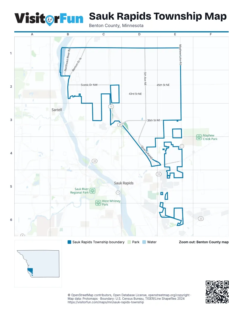
Street index of Sauk Rapids Township
Each street on the sheet and the grid squares it crosses.
- Benton Drive NorthB1, B2
- Northeast River RoadB1, B2
- 5th Avenue NortheastD1, D2, D3
- Mayhew Lake RoadE1
- 16th Avenue NorthwestB2
- 17th Avenue NorthwestB2
- 44th Street NorthwestB2
- 46th Street NorthwestB2
- Mallard Court NorthwestB2
- Marigold Road NorthwestB2
- Marten Court NorthwestB2
- Mayflower Road NorthwestB2
- Mink Loop NorthwestB2
- Mossrose Road NorthwestB2
- Oakland Drive NorthwestB2
- Scenic Drive NorthwestB2, C2
- 43rd Street NortheastD2
- 45th Street NortheastD2, E2
- 35th Street NortheastC3, D3, E3
- County Road 29C3
- MN Highway 15C3
- US Highway 10C3
- Quarry Road NortheastD3, D4, E4
- 10th Avenue NortheastE3, E4, E5
- 2nd Street NorthD4
- Golden Spike Road NortheastE4
- Industrial BoulevardE4
- Mayhew Lake Road NortheastE4, E5
- Ocarina DriveE4
- 10th Street NortheastE6
- 14th Avenue NortheastE6
- 5th Street SouthE6
Places on the map
- Molitor's Quarry Grill & Bar
Next to Sauk Rapids Township
© OpenStreetMap contributors, Open Database License, openstreetmap.org/copyright · Map data: Protomaps · Boundary: U.S. Census Bureau, TIGER/Line Shapefiles 2024















