

Minnesota map
Central Minnesota map
The sheet's index lists 11 highways; I-94, US 10 and MN 27 cross the most grid squares. Things to do inside the boundary: Biggest Ball of Twine in Minnesota, Charles A. Weyerhaeuser Memorial Museum and Crossroads Center. Also on it: Aitkin, Alexandria and Baldwin.
Open the map (PDF, US Letter)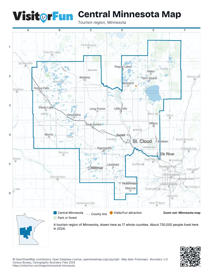
Highway index of Central Minnesota
Each highway on the sheet and the grid squares it crosses.
- I-94A2, A3, B3, B4, C4, D4
- US 10B2, D3, D4
- US 59A2, A3
- US 71C5
- US 169E4, E5
- MN 15D4
- MN 23C5
- MN 27B3, B4, C4
- MN 101E5
- MN 210A2, A3
- MN 371D3
Things to do on the Central Minnesota map
Places on the map
- Aitkin
- Alexandria
- Baldwin
- Brainerd
- Elbow Lake
- Elk River
- Farm Island
- Fergus Falls
- Glencoe
- Hutchinson
- Litchfield
- Little Falls
- Long Prairie
- Milaca
- Morris
- Paynesville
- Pequot Lakes
- Sartell
- Sauk Centre
- St. Cloud
- Wadena
- Willmar
Next to Central Minnesota
© OpenStreetMap contributors, Open Database License, openstreetmap.org/copyright · Map data: Protomaps · Boundary: U.S. Census Bureau, Cartographic Boundary Files 2024