

Missouri map
Southeast Missouri map
The sheet's index lists 21 highways; I-55, US 60 and US 67 cross the most grid squares. Things to do inside the boundary: ASL Pewter, Big Oak Tree State Park and Echo Bluff State Park. Also on it: Advance, Cape Girardeau and Caruthersville.
Open the map (PDF, US Letter)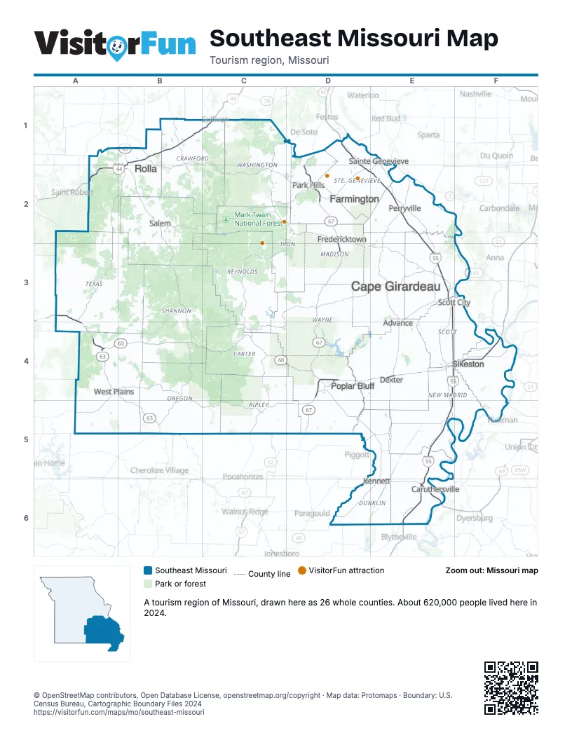
Highway index of Southeast Missouri
Each highway on the sheet and the grid squares it crosses.
- I-44A2, B1, B2, C1
- I-55D1, D2, E2, E3, E4, E5, E6
- I-57E4, F4
- I-155E6
- US 60A3, A4, B4, C4, D4, E4, F4
- US 61E3, E5, E6
- US 62F4
- US 63A4, B1, B4, B5
- US 67D1, D2, D3, D4, D5
- US 160A4
- US 412D6, E6
- MO 17A4, B4
- MO 19B4
- MO 21C4
- MO 32D2
- MO 34E3, F3
- MO 74E3, F3
- MO 77F4
- MO 84E6
- MO 142B5
- IL 146F3
Things to do on the Southeast Missouri map
Places on the map
- Advance
- Cape Girardeau
- Caruthersville
- Dexter
- Farmington
- Fredericktown
- Kennett
- Park Hills
- Perryville
- Poplar Bluff
- Rolla
- Sainte Genevieve
- Salem
- Scott City
- Sikeston
- West Plains
Next to Southeast Missouri
- Arkansas Delta
- Arkansas Ozarks
- Great Rivers Country
- Trails to Adventure
- Western Lakes and Rivers
- Central Missouri map
- Northeast Missouri map
- Southwest Missouri map
- West Tennessee
© OpenStreetMap contributors, Open Database License, openstreetmap.org/copyright · Map data: Protomaps · Boundary: U.S. Census Bureau, Cartographic Boundary Files 2024