

Missouri map
Central Missouri map
The sheet's index lists 20 highways; US 50, US 65 and US 54 cross the most grid squares. Things to do inside the boundary: America's National Churchill Museum, Bennett Spring State Park and Boonville Visitor Center. Also on it: Boonville, Buffalo and California.
Open the map (PDF, US Letter)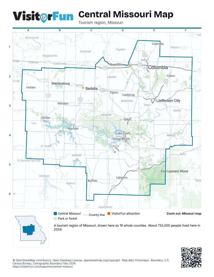
Highway index of Central Missouri
Each highway on the sheet and the grid squares it crosses.
- I-44D5, D6, E5
- I-70C2, D2, E2, F2
- US 40C2, D2, E2, F2
- US 50A2, B2, C2, C3, D3, E3, F3
- US 54D3, D4, E2, E3, F1, F2
- US 63E1, E2, E3, F3, F4
- US 65B3, B4, C2, C3, C4, C5, C6
- MO 5D3, D4, D5
- MO 7A3, B3, B4, C4, D4, D5
- MO 13B2, B3, B4, B5
- MO 28F4
- MO 32D5
- MO 52B3, B4, C3, D3
- MO 64D5
- MO 89F3
- MO 94E3
- MO 124E1
- MO 127B2
- MO 135C2
- MO 179E3
Things to do on the Central Missouri map
Places on the map
- Boonville
- Buffalo
- California
- Centralia
- Clinton
- Columbia
- Eldon
- Fort Leonard Wood
- Fulton
- Holden
- Jefferson City
- Lake Ozark
- Lebanon
- Osage Beach
- Sedalia
- Tipton
- Warrensburg
- Warsaw
- Windsor
Next to Central Missouri
© OpenStreetMap contributors, Open Database License, openstreetmap.org/copyright · Map data: Protomaps · Boundary: U.S. Census Bureau, Cartographic Boundary Files 2024