

Missouri map
St. Charles County map
About 423,726 people live here (Census Bureau, 2024 estimate). The sheet's index lists 6 streets; Avenue of the Saints, Dwight D Eisenhower Highway and Patrick J Bray Memorial Highway cross the most grid squares. Things to do inside the boundary: Fast Lane Classic Cars, Greater St. Charles Visitor Center and Historic Main Street St. Charles.
Open the map (PDF, US Letter)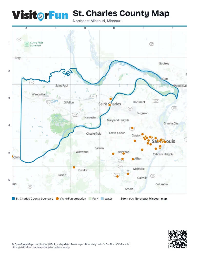
Street index of St. Charles County
Each street on the sheet and the grid squares it crosses.
- Avenue of the SaintsA3, B3, B4, C4
- Dwight D Eisenhower HighwayA3, B3
- Patrick J Bray Memorial HighwayC3, D3
- South First Capitol DriveC3, D3
- Discovery BridgeD3
- Veterans Memorial ParkwayD3
Things to do on the St. Charles County map
Places on the map
- 370 Lakeside Park
- Addyston Place
- Airport Lake
- Amberleigh
- Ameren Sioux Power Plant
- Appaloosa Ranch Estates
- Arrowhead Industrial Park
- Auburn Meadows
- August A Busch Lake Number 33
- August A Busch Lake Number 34
- August A Busch Lake Number 35
- August A Busch Memorial Conservation Area
- Augusta
- Augusta Shores
- Autumn Valley Lakes
- Avondale Hills
- Avondale Meadows
- Avondale Park
- Bangert Island
- Barathaven
- BaratHaven Park
- Barton Creek
- Beach District
- Bear Creek
- Bear Creek Golf Club
- Bedford Falls
- Bellemeade Estates
- Big Country Acres
- Big Lake
- Big Muddy National Fish and Wildlife Refuge
- Birdsong Meadows
- Bogey Hills Country Club
- Boone Ridge Estates
- Boone Valley Golf Club
- Boonslick Gardens
- Brommelsiek Park
- Brookmount Estates
- Brookshire Creek
- Brookside Village
- Bunker Hill
Next to St. Charles County
- Affton
- Alton
- Arnold
- Ballwin
- Cahokia Heights
- Chesterfield
- Clayton
- Columbia
- Concord
- Creve Coeur
- Ellisville
- Eureka
- Ferguson
- Florissant
- Godfrey
- Granite City
- Hazelwood
- Jennings
- Kirkwood
- Lemay
- Maryland Heights
- Mehlville
- Oakville
- Overland
- Pacific
- Saint Ann
- Saint Louis
- Town and Country
- Troy
- Union
- University City
- Wildwood
- Wood River
© OpenStreetMap contributors (ODbL) · Map data: Protomaps · Boundary: Who's On First (CC-BY 4.0)