

Montana map
Glacier Country map
The sheet's index lists 4 highways; I-90, US 93 and MT 200 cross the most grid squares. Things to do inside the boundary: CSKT Bison Range, Flathead Lake Alpine Coaster and Flathead Lake Charters. Also on it: Alberton, Browning and Cut Bank.
Open the map (PDF, US Letter)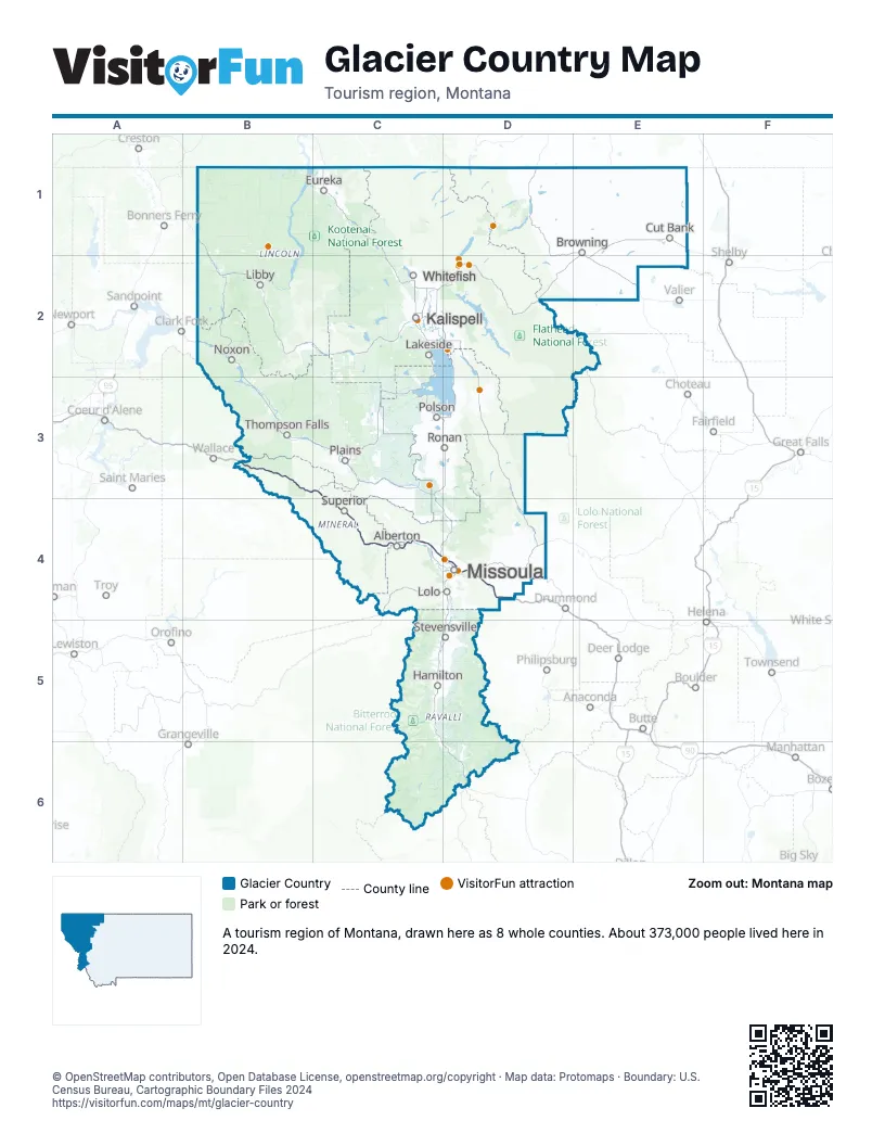
Highway index of Glacier Country
Each highway on the sheet and the grid squares it crosses.
- I-90B3, C3, C4, D4
- US 12D4
- US 93C4, D4
- MT 200C4, D4
Things to do on the Glacier Country map
- CSKT Bison Range
- Flathead Lake Alpine Coaster
- Flathead Lake Charters
- Flathead Lake Monster Charters
- Glacier Distilling
- Glacier Guides and Montana Raft
- Glacier National Park
- Glacier Raft Company
- Goats of Glacier
- Going-to-the-Sun Road
- Great Northern Rafting
- Handmade Montana
- Historical Museum at Fort Missoula
- Kalispell Visitor Information Center
- Missoula People's Market
- National Museum of Forest Service History
- Sculpture in the Wild
- Swan Mountain Outfitters
- Wild River Adventures
Places on the map
- Alberton
- Browning
- Cut Bank
- Eureka
- Hamilton
- Kalispell
- Lakeside
- Libby
- Lolo
- Missoula
- Noxon
- Plains
- Polson
- Ronan
- Stevensville
- Superior
- Thompson Falls
- Whitefish
Next to Glacier Country
- Central Idaho
- North Central Idaho
- Northern Idaho
- Central Montana
- Southwest Montana map
© OpenStreetMap contributors, Open Database License, openstreetmap.org/copyright · Map data: Protomaps · Boundary: U.S. Census Bureau, Cartographic Boundary Files 2024