

Montana map
Southwest Montana map
The sheet's index lists 5 highways; I-15, I-90 and US 12 cross the most grid squares. Things to do inside the boundary: Anaconda, Bannack State Park and Berkeley Pit. Also on it: Boulder, Butte and Deer Lodge.
Open the map (PDF, US Letter)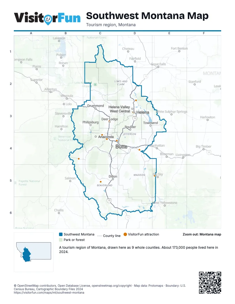
Highway index of Southwest Montana
Each highway on the sheet and the grid squares it crosses.
- I-15C4, C5, C6, D2, D3, D4, D6
- I-90B3, C3, C4, D4
- I-115C4
- US 12B3, C3
- US 287D2, D3
Things to do on the Southwest Montana map
- Anaconda
- Bannack State Park
- Berkeley Pit
- Big Hole National Battlefield
- Big Sky Resort
- Fairmont Hot Springs Resort
- Gates of the Mountains
- Grant-Kohrs Ranch National Historic Site
- Lewis and Clark Caverns State Park
- Montana State Capitol
- Montana Zipline Adventures
- Montana's Yellowstone Country
- Old Montana Prison Museum Complex
- Sapphire Gallery & Sweet Palace
- Western Montana's Glacier Country
Places on the map
- Anaconda
- Boulder
- Butte
- Deer Lodge
- Dillon
- Drummond
- Helena
- Helena Valley West Central
- Philipsburg
- Townsend
Next to Southwest Montana
- Central Idaho
- Eastern Idaho
- Central Montana
- Glacier Country map
- Yellowstone Country
© OpenStreetMap contributors, Open Database License, openstreetmap.org/copyright · Map data: Protomaps · Boundary: U.S. Census Bureau, Cartographic Boundary Files 2024