

North Carolina map
North Carolina map
Things to do inside the boundary: Airborne & Special Operations Museum, Battleship North Carolina and Billy Graham Library. Also on it: Alligator River National Wildlife Refuge, B. Everett Jordan Project and Bladen Lakes State Forest. Just past the edge: Albany, Athens and Atlanta.
Open the map (PDF, US Letter)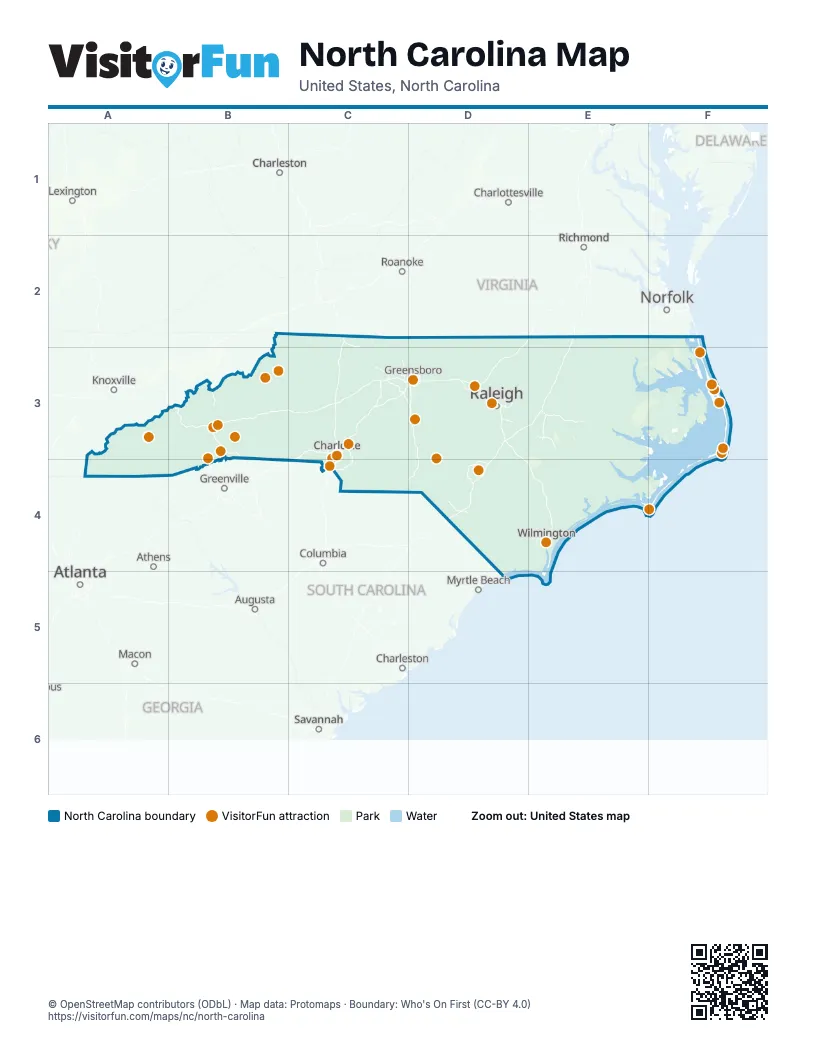
Maps inside North Carolina
13 maps inside, from the street map of North Carolina down.
Things to do on the North Carolina map
- Airborne & Special Operations Museum
- Battleship North Carolina
- Billy Graham Library
- Biltmore Estate
- Blue Ridge Parkway
- Bodie Island Lighthouse
- Cape Hatteras Lighthouse
- Cape Hatteras National Seashore
- Cape Lookout National Seashore
- Carl Sandburg Home National Historic Site
- Charlotte Motor Speedway
- Chimney Rock at Chimney Rock State Park
- Currituck Beach Lighthouse
- Discovery Place Science
- Duke University Chapel
- DuPont State Recreational Forest
- Grandfather Mountain
- Great Smoky Mountains Railroad
- International Civil Rights Center & Museum
- Jockey's Ridge State Park
- NASCAR Hall of Fame
- North Carolina Museum of Art
- North Carolina Zoo
- Pinehurst Resort
- Tweetsie Railroad
- Wright Brothers National Memorial
Places on the map
- Alligator River National Wildlife Refuge
- B. Everett Jordan Project
- Bladen Lakes State Forest
- Blue Ridge Parkway
- Butner-Falls of Neuse Game Land
- Cape Hatteras National Seashore
- Cape Lookout National Seashore
- Caswell Gameland
- Croatan National Forest
- Dare County Bombing Range
- Fort Bragg
- Gull Rock Game Land
- Hofmann Forest
- Holly Shelter Game Land
- Jordan Game Land
- Little Sugar Creek Greenway
- Lumber River State Park
- Marine Corps Base Camp Lejeune
- Nantahala National Forest
- NC Zoological Society
- Needmore Gameland
- New River State Park
- North Carolina Zoo
- Pettigrew State Park
- Pisgah National Forest
- Pisgah WRC Game Land
- Pocosin Lakes National Wildlife Refuge
- Roanoke River Wetlands
- Sandhills Game Land
- South Mountains Game Land
- South Mountains State Park
- Southern Nantahala Wilderness
- Uwharrie National Forest
Next to North Carolina
- Albany
- Athens
- Atlanta
- Augusta
- Charleston
- Charlottesville
- Columbia
- Greenville
- Knoxville
- Lexington
- Macon
- Myrtle Beach
- Norfolk
- Richmond
- Roanoke
- Savannah
© OpenStreetMap contributors (ODbL) · Map data: Protomaps · Boundary: Who's On First (CC-BY 4.0)