

New Hampshire map
Merrimack Valley map
The sheet's index lists 17 highways; US 4, I-89 and I-93 cross the most grid squares. Things to do inside the boundary: Canterbury Shaker Village, Daniel Webster Birthplace State Historic Site and League of NH Craftsmen Fine Craft Gallery. Also on it: Bow, Bradford and Concord.
Open the map (PDF, US Letter)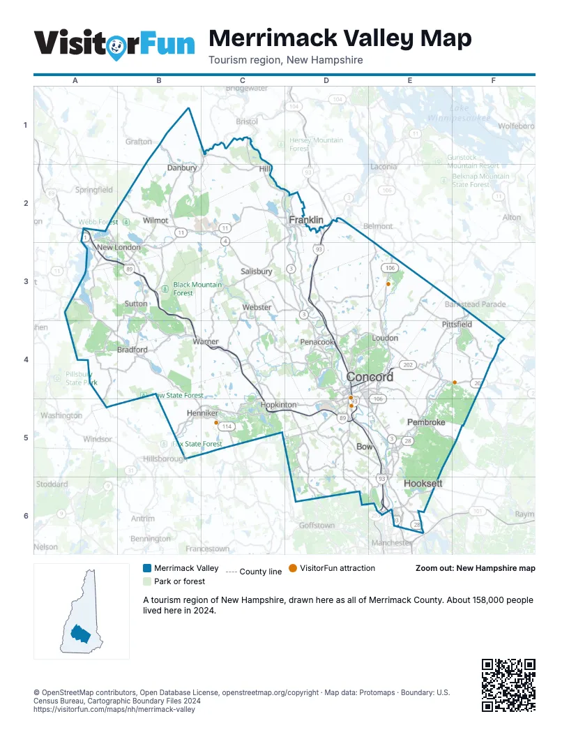
Highway index of Merrimack Valley
Each highway on the sheet and the grid squares it crosses.
- I-89A2, A3, B3, B4, C4, C5, D5
- I-93D2, D3, D4, D5, E5, E6
- I-293E6
- I-393D4, E4
- US 3D2, D3, D4, D5, E5, E6
- US 4B1, B2, C2, C3, D3, D4, E4, F4
- US 202B5, C5, D4, D5, E4, F4
- NH 3AD2, D5
- NH 4AB2
- NH 9B5, C5, D4, D5, E4, F4
- NH 11A2, A3, B2, B3, C2, D2
- NH 28E4, E5, E6, F3
- NH 104B2, C1, C2
- NH 106E3, E4, E5
- NH 107F4
- NH 114B5, C5
- NH 127D2
Things to do on the Merrimack Valley map
Places on the map
- Bow
- Bradford
- Concord
- Danbury
- Franklin
- Henniker
- Hill
- Hooksett
- Hopkinton
- Loudon
- New London
- Pembroke
- Penacook
- Pittsfield
- Salisbury
- Sutton
- Warner
- Webster
- Wilmot
Next to Merrimack Valley
© OpenStreetMap contributors, Open Database License, openstreetmap.org/copyright · Map data: Protomaps · Boundary: U.S. Census Bureau, Cartographic Boundary Files 2024