

New Hampshire map
New Hampshire map
Things to do inside the boundary: Adventure Suites, Ashuelot Concerts and Canobie Lake Park. Also on it: 13 Mile Woods Community Forest, Andorra Forest and Appalachian National Scenic Trail. Just past the edge: Augusta, Burlington and Lewiston.
Open the map (PDF, US Letter)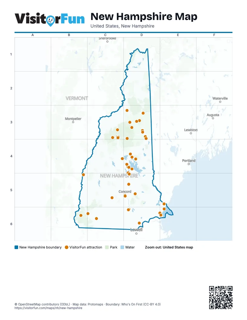
Maps inside New Hampshire
2 maps inside, from the street map of New Hampshire down.
Things to do on the New Hampshire map
- Adventure Suites
- Ashuelot Concerts
- Canobie Lake Park
- Captain's Cove Adventure Golf
- Castle in the Clouds
- Clark's Bears
- Conway Scenic Railroad
- Crawford Notch State Park
- Currier Museum of Art
- Fay's Boat Yard
- Franconia Notch State Park
- Funspot
- Granite State Railway
- Granite State Whale Watch
- Great Glen Trails Outdoor Center
- Greater Manchester Chamber
- Hampton Beach
- Howard's Leather Store
- Kancamagus Highway
- Laconia Rail Bikes
- League of NH Craftsmen Fine Craft Gallery
- Lost River Gorge & Boulder Caves
- M/S Mount Washington
- Manchester Museums
- Merrill Fay Arena
- Millyard Museum
- Monadnock Region
- Mount Monadnock
- Mount Washington Auto Road
- Mount Washington Cog Railway
- Nestlenook Farm
- New Hampshire Camping
- New Hampshire Heritage Museum Trail
- New Hampshire Motor Speedway
- Omni Mount Washington Resort
- Pats Peak
- Portsmouth and the Seacoast
- Portsmouth Harbor Cruises
- S&W Sports
- Saint-Gaudens National Historical Park
- Sandwich Fair
- Santa's Village
- SEE Science Center
- Settlers Green Outlet Village
- Squam Lakes Natural Science Center
- Story Land
- Strawbery Banke Museum
- The Loon Center
- Western White Mountains
- White Mountains
- Winnipesaukee Railway
Places on the map
- 13 Mile Woods Community Forest
- Andorra Forest
- Appalachian National Scenic Trail
- Bear Brook State Park
- Bunnell Working Forest
- Cardigan Mountain State Forest
- Connecticut Lakes Headwaters Working Forest
- Connecticut Lakes State Forest
- Corbin Park
- Crawford Notch State Park
- Franklin Falls Reservoir
- Gile State Forest
- Great Gulf Wilderness
- Green Woodlands
- Hopkinton-Everett Reservoir
- Jericho Mountain State Park
- Lincoln Woods Scenic Area
- Manchester Waterworks
- Monadnock Reservation
- Mount Chocorua Scenic Area
- Mount Kearsarge State Forest
- Nash Stream Forest
- New Boston Space Force Station
- Pawtuckaway State Park
- Pemigewasset Wilderness
- Pinkham Notch Scenic Area
- Pisgah State Park
- Presidential Range-Dry River Wilderness
- Randolph Community Forest
- Sandwich Range Wilderness
- Second College Grant
- Umbagog State Park
- Vickie Bunnell Preserve
- White Mountain National Forest
- Wild River Wilderness
Next to New Hampshire
- Augusta
- Burlington
- Lewiston
- Lowell
- Montpelier
- Portland
- Sherbrooke
- Waterville
© OpenStreetMap contributors (ODbL) · Map data: Protomaps · Boundary: Who's On First (CC-BY 4.0)