

New Hampshire map
Seacoast map
The sheet's index lists 12 highways; US 4, NH 16 and NH 125 cross the most grid squares. Things to do inside the boundary: Canobie Lake Park, Captain's Cove Adventure Golf and Fort Stark State Historic Site. Also on it: Derry, Dover and Durham.
Open the map (PDF, US Letter)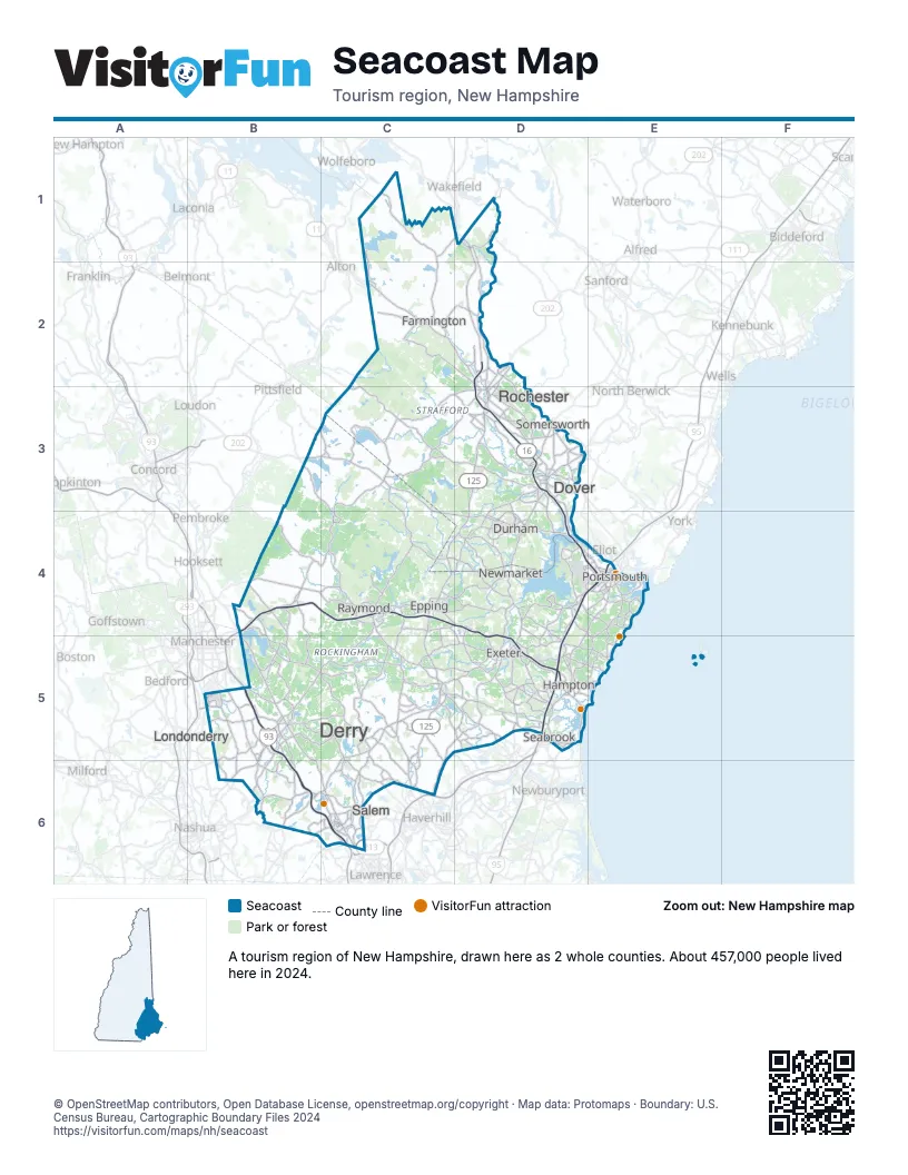
Highway index of Seacoast
Each highway on the sheet and the grid squares it crosses.
- I-93B5, B6, C6
- I-95D4, D5, E4
- US 1E4
- US 4B3, C3, C4, D4, E4
- US 202B3, C3, D2, D3
- NH 9B3, C3
- NH 11C2, D2
- NH 16D1, D2, D3, D4, E4
- NH 101B4, C4, D4, D5
- NH 107B3, C3, C5
- NH 111C5
- NH 125C4, C5, C6, D3, D4
Things to do on the Seacoast map
- Canobie Lake Park
- Captain's Cove Adventure Golf
- Fort Stark State Historic Site
- Granite State Whale Watch
- Kingston State Park
- Moffatt-Ladd House
- New Hampshire Heritage Museum Trail
- North Hampton State Beach
- Odiorne Point State Park
- Pawtuckaway State Park
- Portsmouth and the Seacoast
- Portsmouth Athenæum
- Portsmouth Harbor Cruises
- Robert Frost Farm Historic Site
- Strawbery Banke Museum
- Wallis Sands State Park
- Wentworth-Coolidge Mansion
- White Island State Historic Site
Places on the map
- Derry
- Dover
- Durham
- Epping
- Exeter
- Farmington
- Hampton
- Londonderry
- Newmarket
- Portsmouth
- Raymond
- Rochester
- Salem
- Seabrook
- Somersworth
Next to Seacoast
- North of Boston
- The Maine Beaches
- Lakes Region map
- Merrimack Valley map
- Monadnock map
© OpenStreetMap contributors, Open Database License, openstreetmap.org/copyright · Map data: Protomaps · Boundary: U.S. Census Bureau, Cartographic Boundary Files 2024