

New Hampshire map
Lakes Region map
The sheet's index lists 9 highways; NH 16, I-93 and NH 11 cross the most grid squares. Things to do inside the boundary: Adventure Suites, Castle in the Clouds and Conway Scenic Railroad. Also on it: Alton, Bartlett and Belmont.
Open the map (PDF, US Letter)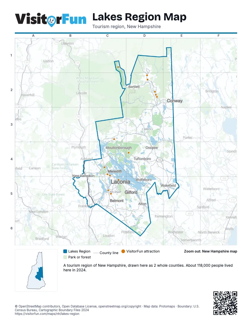
Highway index of Lakes Region
Each highway on the sheet and the grid squares it crosses.
- I-93B4, B5, C5
- US 3B5, C5
- US 302D2, E2
- NH 11B5, C5, D5
- NH 16D1, D2, D3, D4, E4, E5
- NH 25D3, D4
- NH 28AD5
- NH 113D2, D3
- NH 132C5
Things to do on the Lakes Region map
- Adventure Suites
- Castle in the Clouds
- Conway Scenic Railroad
- Crawford Notch State Park
- Echo Lake State Park
- Fay's Boat Yard
- Funspot
- Governor Wentworth Historic Site
- Laconia Rail Bikes
- M/S Mount Washington
- Merrill Fay Arena
- Nestlenook Farm
- Northern Extremes Snowmobile Rentals
- Sandwich Fair
- Settlers Green Outlet Village
- Story Land
- The Loon Center
- Winnipesaukee Railway
Places on the map
- Alton
- Bartlett
- Belmont
- Conway
- Gilford
- Laconia
- Meredith
- Moultonborough
- New Hampton
- Ossipee
- Tuftonboro
- Wakefield
- Wolfeboro
Next to Lakes Region
- Maine's Lakes & Mountains
- The Maine Beaches
- Great North Woods map
- Merrimack Valley map
- Seacoast map
- White Mountains map
© OpenStreetMap contributors, Open Database License, openstreetmap.org/copyright · Map data: Protomaps · Boundary: U.S. Census Bureau, Cartographic Boundary Files 2024