

New Jersey map
Greater Atlantic City Region map
The sheet's index lists 14 highways; US 30, US 40 and US 322 cross the most grid squares. Things to do inside the boundary: Absecon Lighthouse, Borgata Hotel Casino & Spa and Caesars Atlantic City. Also on it: Brigantine, Corbin City and Egg Harbor Township.
Open the map (PDF, US Letter)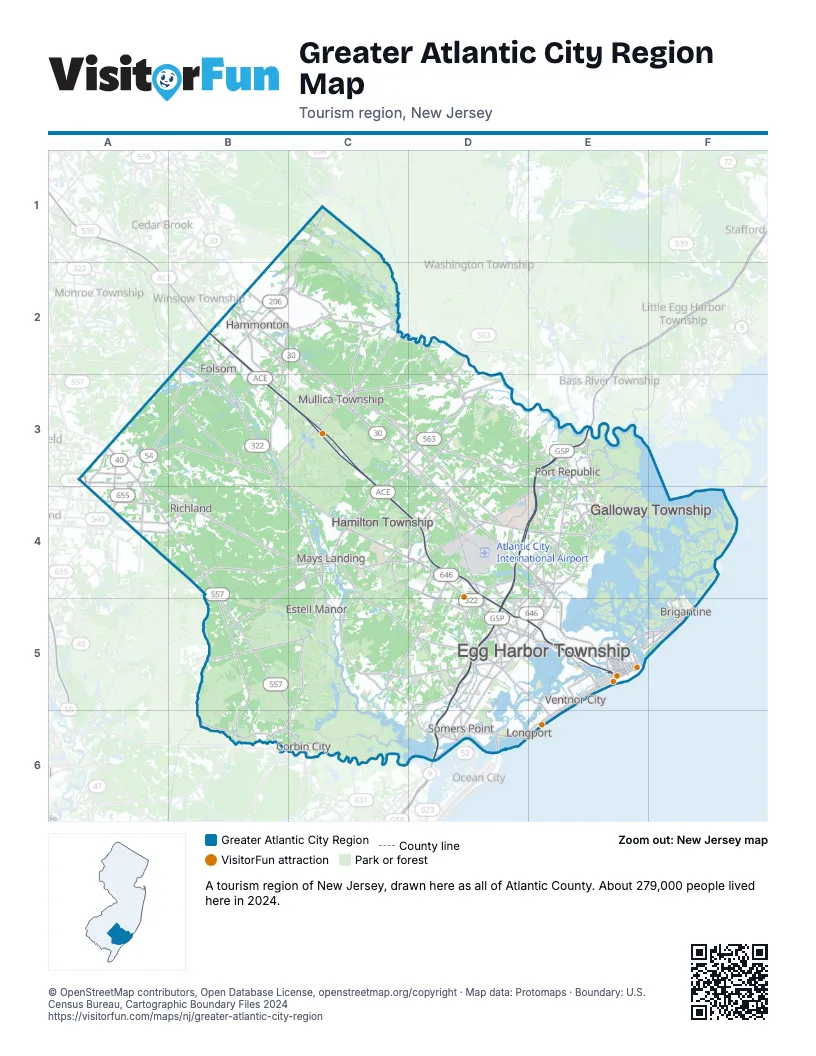
Highway index of Greater Atlantic City Region
Each highway on the sheet and the grid squares it crosses.
- US 9D5, D6, E3, E4, E5
- US 30B2, C2, C3, D3, D4, E4, E5
- US 40A3, A4, B4, C4, D4, D5, E5
- US 206B2, C1, C2
- US 322B2, B3, C4, D4, D5, E5
- NJ 49B6
- NJ 50B6, C3, C4, C5, C6, D3
- NJ 52D6
- NJ 54A3, B2, B3
- NJ 73B2, B3
- NJ 87E5
- NJ 152D6
- NJ 157E4
- NJ 187E5
Things to do on the Greater Atlantic City Region map
- Absecon Lighthouse
- Borgata Hotel Casino & Spa
- Caesars Atlantic City
- Frank S. Farley Service Plaza
- Golden Nugget Atlantic City
- Hamilton Mall
- Hard Rock Hotel & Casino Atlantic City
- Harrah's Resort Atlantic City
- Historic Smithville & Village Greene
- Jim Whelan Boardwalk Hall
- Lucy the Elephant
- Noyes Museum of Art
- Ocean Casino Resort
- Resorts Casino Hotel
- Storybook Land
- Tanger Outlets Atlantic City
- Tropicana Atlantic City
Places on the map
- Brigantine
- Corbin City
- Egg Harbor Township
- Estell Manor
- Folsom
- Galloway Township
- Hamilton Township
- Hammonton
- Longport
- Mays Landing
- Mullica Township
- Port Republic
- Richland
- Somers Point
- Ventnor City
Next to Greater Atlantic City Region
© OpenStreetMap contributors, Open Database License, openstreetmap.org/copyright · Map data: Protomaps · Boundary: U.S. Census Bureau, Cartographic Boundary Files 2024