

New Jersey map
Shore Region map
The sheet's index lists 13 highways; US 9, NJ 35 and I-195 cross the most grid squares. Things to do inside the boundary: Barnegat Light Public School, Barnegat Lighthouse State Park and Bruce Springsteen Center for American Music. Also on it: Barnegat Township, Beach Haven and Berkeley Township.
Open the map (PDF, US Letter)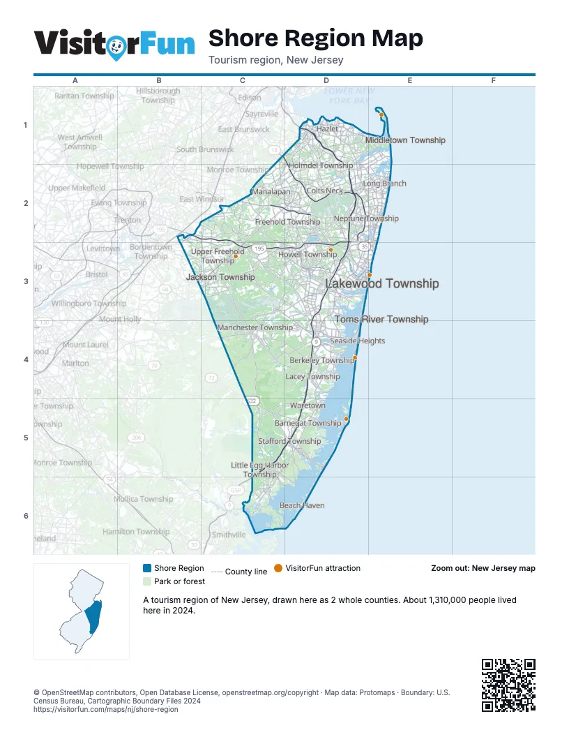
Highway index of Shore Region
Each highway on the sheet and the grid squares it crosses.
- I-195B2, C2, C3, D2, D3
- US 9C1, C2, C5, C6, D2, D3, D4, D5
- NJ 18C1, D2
- NJ 33C2, D2, E2
- NJ 34D2, D3
- NJ 35D1, D2, D3, D4, E2, E3
- NJ 36D1, D2, E1, E2
- NJ 37C3, D3, D4
- NJ 66D2
- NJ 70C3, C4, D3
- NJ 71E2
- NJ 72C5, D5
- NJ 138D2
Things to do on the Shore Region map
- Barnegat Light Public School
- Barnegat Lighthouse State Park
- Bruce Springsteen Center for American Music
- Circle A Stables
- Freehold Raceway Mall
- Freneau Woods Park
- Holmdel Park
- Island Beach State Park
- Jenkinson's Boardwalk
- Monmouth County Historical Association
- New Jersey Maritime Museum
- Sandy Hook
- Six Flags Great Adventure
- The Stone Pony
- Thompson Park
- Tuckerton Seaport
Places on the map
- Barnegat Township
- Beach Haven
- Berkeley Township
- Colts Neck
- Freehold Township
- Hazlet
- Holmdel Township
- Howell Township
- Jackson Township
- Lacey Township
- Lakewood Township
- Little Egg Harbor Township
- Long Branch
- Manalapan
- Manchester Township
- Middletown Township
- Neptune Township
- Seaside Heights
- Stafford Township
- Toms River Township
- Upper Freehold Township
- Waretown
Next to Shore Region
© OpenStreetMap contributors, Open Database License, openstreetmap.org/copyright · Map data: Protomaps · Boundary: U.S. Census Bureau, Cartographic Boundary Files 2024