

New Mexico map
Bernalillo County map
About 671,747 people live here (Census Bureau, 2024 estimate). The sheet's index lists 4 streets; Pan American Freeway, Coronado Freeway and Paseo del Norte Boulevard Northwest cross the most grid squares. Things to do inside the boundary: ABQ BioPark, Albuquerque and Albuquerque International Balloon Fiesta.
Open the map (PDF, US Letter)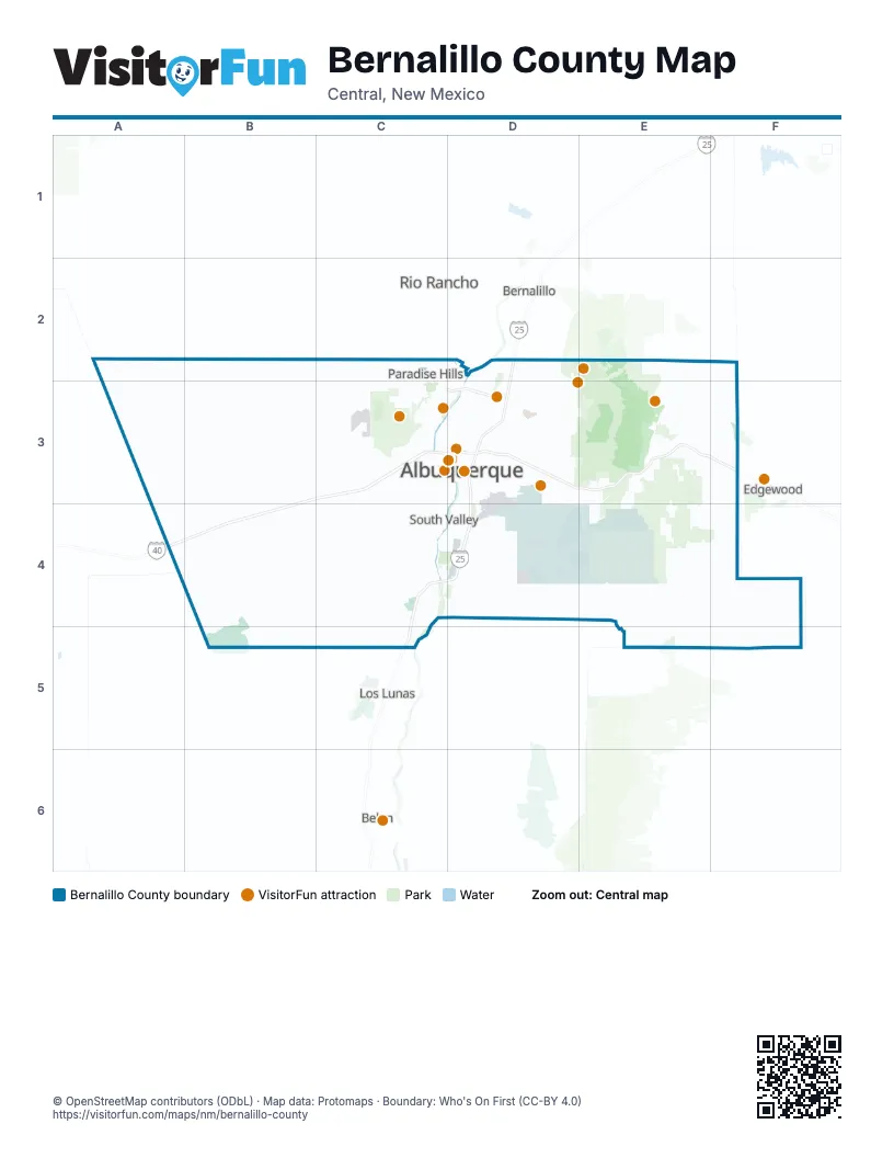
Maps inside Bernalillo County
1 map inside, from the street map of Bernalillo County down.
Street index of Bernalillo County
Each street on the sheet and the grid squares it crosses.
- Pan American FreewayD2, D3, C4, D4, C5
- Coronado FreewayC3, D3
- Paseo del Norte Boulevard NorthwestC3, D3
- Paseo del Norte Boulevard NortheastD3
Things to do on the Bernalillo County map
- ABQ BioPark
- Albuquerque
- Anderson Abruzzo Albuquerque International Balloon Museum
- Breaking Bad RV Tours
- Indian Pueblo Cultural Center
- National Museum of Nuclear Science and History
- New Mexico Museum of Natural History and Science
- Old Town Albuquerque
- Sandia Peak Aerial Tramway
- Sandia Peak Tramway
- Turquoise Trail
- Warpath Traders
- World Balloon
Places on the map
- Aerial Cable Facility Complex
- Alameda Bosque
- Albuquerque
- Albuquerque Biological Park
- Albuquerque International Sunport
- Albuquerque Studios
- Apple Valley Ranch
- Arroyo Del Oso Championship
- Balloon Fiesta Park
- Bear Canyon Open Space West
- Bear Canyon Scenic Easement
- Bernalillo County
- Canyon Estates
- Carlito Springs Open Space
- Carnuel
- Casa Grande Linear Park
- Cedar Crest
- Cedar Oaks
- Cerro Colorado Landfill
- CHESTNUT
- Chilili/CDP
- Cottonwood Mall
- Desert Greens Golf Course
- DOE Buffer Zone
- East Tijeras Arroyo Open Space
- Expo New Mexico
- Four Hills Golf Course
- Four Hills Mobile Home Park
- Huning Castle
- Inspiration Subdivision
- Isleta
- Isleta Eagle Golf Course
- Isleta Lakes & RV Park
- Joint-Use Area
- Juan Tomas Open Space
- Kirtland Air Force Base
- Kirtland Air Force Base & Cibola Withdrawal Area
- Ladera Golf Course
- Las Estancias Shopping Center
- Las Terrazas
Next to Bernalillo County
- Belen
- Bernalillo
- Edgewood
- Los Lunas
- Peralta
- Rio Rancho
© OpenStreetMap contributors (ODbL) · Map data: Protomaps · Boundary: Who's On First (CC-BY 4.0)