

New Mexico map
North Central New Mexico map
The sheet's index lists 10 highways; US 285, US 84 and NM 68 cross the most grid squares. Things to do inside the boundary: Bradbury Science Museum, Canyon Road Arts District and Casa Alpaca and Fiberworks. Also on it: Dulce, Edgewood and Española.
Open the map (PDF, US Letter)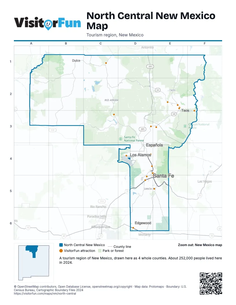
Highway index of North Central New Mexico
Each highway on the sheet and the grid squares it crosses.
- I-25D5, E5
- I-40D6
- US 64D2, E2
- US 84D3, D4, D5, E4
- US 285D1, D2, D3, D4, D5, E2, E3, E4, E5, E6
- US 550A3
- NM 4D4
- NM 68D3, D4, E2, E3
- NM 502D4
- NM 599D4, D5
Things to do on the North Central New Mexico map
- Bradbury Science Museum
- Casa Alpaca and Fiberworks
- Cathedral Basilica of St. Francis of Assisi
- Cumbres & Toltec Scenic Railroad
- El Santuario de Chimayo
- Elissa Heyman Psychic Counseling and Spiritual Healing
- Enchanted Circle Pottery
- Georgia O'Keeffe Museum
- Ghost Ranch
- Kokopelli Rafting Adventures
- La Fonda on the Plaza
- Loretto Chapel
- Meow Wolf: House of Eternal Return
- Millicent Rogers Museum
- Museum of International Folk Art
- Nambe Falls Recreation Area
- New Wave Rafting
- Palace of the Governors
- Reflective Jewelry
- Rio Grande Gorge Bridge
- Santa Fe Indian Market
- Santa Fe Opera
- Santa Fe Plaza
- Solitary Angler
- The Shed
- Wild Earth Llama Adventures
- Wildlife West Nature Park
Places on the map
- Dulce
- Edgewood
- Española
- Los Alamos
- Santa Fe
- Taos
Next to North Central New Mexico
- Mountains & Mesas
- Mystic San Luis Valley
- Central New Mexico
- Northeast New Mexico map
- Northwest New Mexico map
© OpenStreetMap contributors, Open Database License, openstreetmap.org/copyright · Map data: Protomaps · Boundary: U.S. Census Bureau, Cartographic Boundary Files 2024