

New York map
Buffalo River map
A printable two-page map of Buffalo River (Buffalo, New York), drawn by VisitorFun from OpenStreetMap. Page two is the street index: every street on the sheet with its grid square, the same list as below.
Open the map (PDF, US Letter)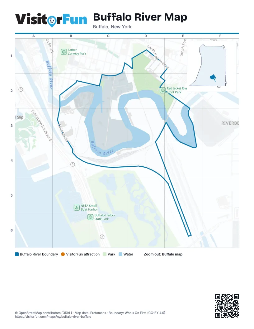
Street index of Buffalo River
Each street on the sheet and the grid squares it crosses.
- Fitzgerald StreetC1
- O'Connell AvenueC1
- Bolton PlaceD1
- Buffalo River PlaceD1
- Euclid PlaceD1
- Harvey PlaceD1
- Leddy StreetD1
- South Park AvenueD1
- St Stephens PlaceE1, D2
- Silo City RowB2, B3
- St Clair StreetB2
- Hamburg StreetC2
- Katherine StreetC2, C3, C4
- South StreetC2
- Vandalia StreetC2
- Smith StreetD2, E2
- Ganson StreetB3
- Ohio StreetB3, B4
Places on the map
- American/Peavey
- American/Peavey Elevator
- Buffalo Creek Junction
- Cargill Superior Elevator
- Concrete-Central Elevator
- CP 2
- CP DRAW
- duende at silo city
- Electric Annex
- Lake & Rail Elevator
- Marine A Elevator
- Mutual Park
- Perot
- Perot Elevator
- Pier
- Red Jacket Peninsula
- Red Jacket River Front Park
- Redmond Park
- Silo City
- Valley Community Association
Next to Buffalo River
- Bell Slip
- RiverBend
© OpenStreetMap contributors (ODbL) · Map data: Protomaps · Boundary: Who's On First (CC-BY 4.0)