

New York map
Cunningham Park map
A printable two-page map of Cunningham Park (Queens, New York), drawn by VisitorFun from OpenStreetMap. Page two is the street index: every street on the sheet with its grid square, the same list as below.
Open the map (PDF, US Letter)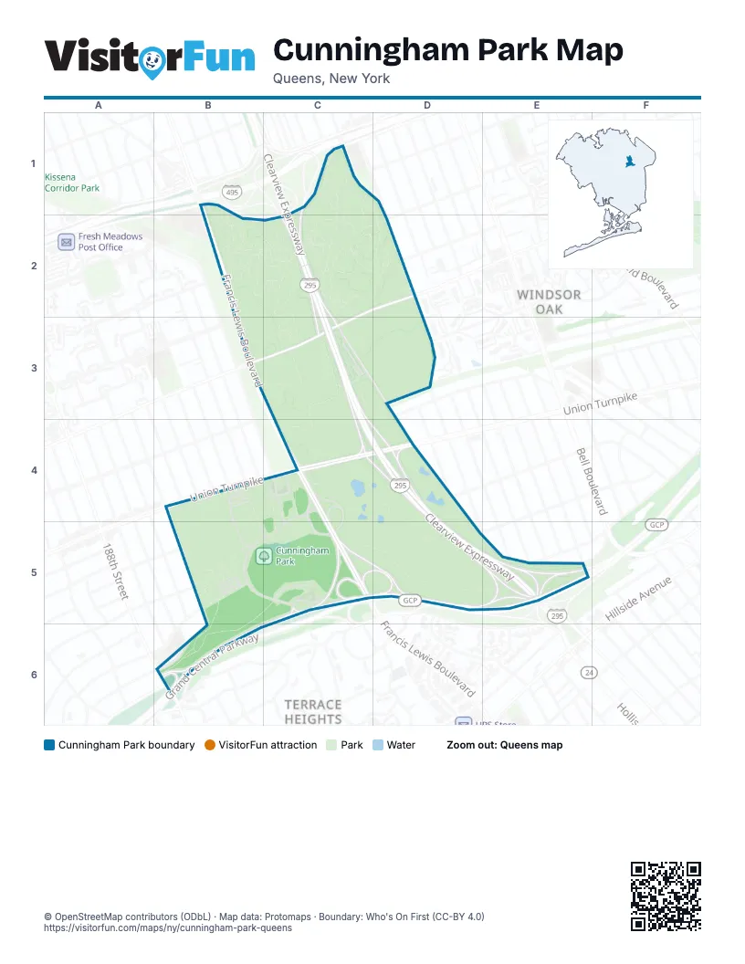
Street index of Cunningham Park
Each street on the sheet and the grid squares it crosses.
- Horace Harding ExpresswayB1, C1, B2, C2
- Francis Lewis BoulevardB2, B3, C4, C5
- 73rd AvenueC2, D2, B3, C3
- Clearview ExpresswayC2, C3, C4, D4, D5, E5
- Hollis Hills TerraceC3
- Union TurnpikeB4, C4, D4
- 199th StreetC4
- 208th StreetD4
- 82nd AvenueD4
- Hollis Court BoulevardD4, E5
- Aberdeen RoadB5
- Radnor RoadB5
- Grand Central ParkwayC5, D5, E5, B6, C6
- 212th StreetE5
- 86th RoadE5
- 193rd StreetB6
- Avon RoadB6
Places on the map
- 73rd & 210th Street
- 73rd Avenue & Clearview Expressway
- 73rd Avenue & Francis Lewis Boulevard
- 73rd Avenue & Hollis Hills Terrace
- Cunningham Park
- Cunningham Park Entrance
- Cunningham Park Playground
- Francis Lewis Boulevard & Horace Harding Expressway
- Francis Lewis Boulevard & Union Turnpike
- James J. FitzGerald Memorial Plaque
- Union Turnpike & 193rd Street
- Union Turnpike & 198th Street
- Union Turnpike & Francis Lewis Boulevard
Next to Cunningham Park
- Terrace Heights map
- Windsor Oak
© OpenStreetMap contributors (ODbL) · Map data: Protomaps · Boundary: Who's On First (CC-BY 4.0)