

New York map
Fruit Belt map
A printable two-page map of Fruit Belt (Buffalo, New York), drawn by VisitorFun from OpenStreetMap. Page two is the street index: every street on the sheet with its grid square, the same list as below.
Open the map (PDF, US Letter)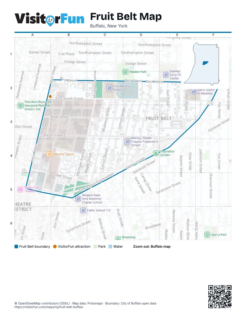
Street index of Fruit Belt
Each street on the sheet and the grid squares it crosses.
- East North StreetA2, B2, C2, D2, E2, F2
- Main StreetA2, A4
- North StreetA2
- Saint Paul StreetA2, B2
- Best StreetB2, C2, F2
- Ellicott StreetB2, A5
- Goodrich StreetB2, B3, C3
- Jackson TerraceB2
- Old Best StreetB2
- Saint Paul Mall NorthB2
- Fosdick AvenueC2
- Locust StreetC2, C3, C4, C5
- Maple StreetC2, C4, B5
- Masten AvenueC2
- Michigan AvenueC2, C3, B4, B5
- Mulberry StreetC2, C5
- Grape StreetD2, D4
- Jefferson AvenueD2, D3, D4
- Lemon StreetD2, C3, C4
- Orange StreetD2, D3, C4, D4
- Peach StreetD2, D4
- Rose StreetD2, D3, D4
- Roehrer AvenueE2
- Timon StreetE2, E3
- Kensington ExpresswayF2, E3, F3, C4, D4, E4, B5, C5
- Sherman StreetF2
- Wohlers AvenueF2
- Washington StreetA3, A4
- Carlton StreetB3, C3, D3, E3
- Elm StreetB3, B4, B5
- North Oak StreetB3, B4, B5
- High StreetC3, D3, E3, F3
- Beech StreetD3, D4
- Cayuga StreetD3, E3
- Alwin PlaceE3, F3
- Earl PlaceE3
- Pershing AvenueE3
- Johnson StreetF3
- Burton StreetA4
- Goodell StreetA4, A5, B5, C5
- Virginia StreetA4, B4, C4, D4
- Alice CourtB4
- Bennett LaneB4, B5
- Burnie LaneB4
- Mabel CourtB4
- Mable CourtB4
- BFMC DriveC4, D4, C5
- Cherry StreetC4, D4, B5, C5
- Mortimer StreetC4
- East Tupper StreetB5
- Oak StreetB5
- Spruce StreetB5
- Hickory StreetC5
- Spring StreetC5
Things to do on the Fruit Belt map
Places on the map
- 589 Ellicott Lot
- 880 Ellicott Ramp
- Anchor Bar
- Buffalo General Medical Center/Gates Vascular Institute
- Buffalo Niagara Medical Campus
- City Honors School
- Darul Uloom Al Madania
- Eastman Machine
- Fruit Belt
- Futures Garden
- Golisano Children’s Hospital of Buffalo
- Inspiration Garden
- Marva J. Daniel Futures Preparatory School
- Masten Avenue Armory
- McCarley Gardens
- Research Institute on Addictions Parking Lot
- Roswell Park Cancer Institute
- Roswell Park Comprehensive Cancer Center
- Saint Jude Diocesan Shrine
- St. John Baptist Church
- State of New York Dept. of Transportation Buffalo Sub-Headquarters
- The Church of Jesus Christ of Latter-day Saints
- Ullrich's Tavern
- Wyndham Garden Buffalo Downtown
Next to Fruit Belt
- Theatre District
© OpenStreetMap contributors (ODbL) · Map data: Protomaps · Boundary: City of Buffalo open data