

New York map
Kenfield map
A printable two-page map of Kenfield (Buffalo, New York), drawn by VisitorFun from OpenStreetMap. Page two is the street index: every street on the sheet with its grid square, the same list as below.
Open the map (PDF, US Letter)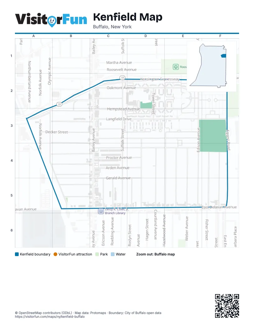
Street index of Kenfield
Each street on the sheet and the grid squares it crosses.
- Kensington ExpresswayA2, B2, C2, A3
- Olympic AvenueA2, A3, A4, B5
- Cloverdale AvenueB2, C2, B3
- Bailey AvenueC2, C5
- Oakmont AvenueC2, D2, E2
- Ruspin AvenueC2
- Suffolk StreetC2, C3, C5
- Tower StreetD2, D3
- Congressional WalkE2, F2
- Edison AvenueE2, E3, E4, E5
- Hempstead AvenueE2, C3, D3, E3
- Kenfield CourtE2
- Eggert RoadF2, F3
- Connelly AvenueA3, B3, C3
- Decker StreetA3, B3, C3
- Manhart StreetA3, B3, B4, C4
- Norfolk AvenueA3, A4
- Warwick AvenueA3, B3, C3
- Erskine AvenueC3
- Langfield DriveC3, E3, F3
- Langfield Service RoadC3, D3
- Weston AvenueC3, E3
- Newburgh AvenueD3, D5
- Hazelwood AvenueE3, E4, E5
- Beiter WalkF3
- Collins WalkF3
- Sugar RoadF3
- Alma AvenueA4, B4, C4
- Dorris AvenueA4, B4, C4
- Schreck AvenueB4, C4
- Arden AvenueC4, D4
- Easton AvenueC4, D4, E4
- Proctor AvenueC4, D4
- Courtland AvenueD4, D5
- Harriet AvenueE4, E5
- Wilkes AvenueE4, E5
- Roma AvenueF4, F5
- Wright AvenueF4, F5
- Kermit AvenueB5, C5
- Langmeyer AvenueB5, C5
- William L Gaiter ParkwayB5
- Ericson AvenueC5
- Gerald AvenueC5, D5
- Roebling AvenueC5
- Roslyn StreetD5
Places on the map
- Buffalo Police Department E District
- Congressional Walk
- Fastrac
- Fastrac Cafe
- Kenfield Homes
- Kermit & Olympic Triangle
- Kingdom Hall of Jehovah’s Witnesses
- Langfield Homes
- Martha Mitchell Center
- PS 156 Frederick Law Olmsted
- Public School 82
- Saint Gerards School
- Saint Lawrence School
- St. Lawrence Catholic Church
© OpenStreetMap contributors (ODbL) · Map data: Protomaps · Boundary: City of Buffalo open data