

New York map
Manhattan Beach map
A printable two-page map of Manhattan Beach (Brooklyn, New York), drawn by VisitorFun from OpenStreetMap. Page two is the street index: every street on the sheet with its grid square, the same list as below.
Open the map (PDF, US Letter)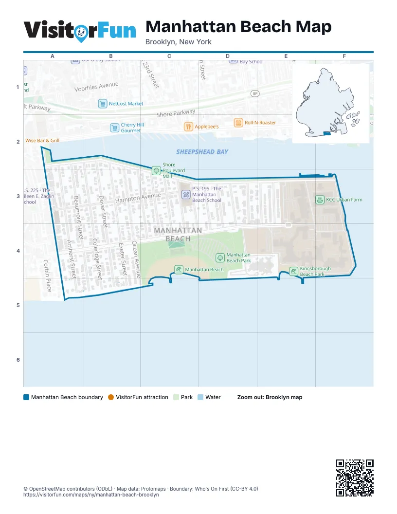
Street index of Manhattan Beach
Each street on the sheet and the grid squares it crosses.
- Amherst StreetA2, A3, A4, A5
- Beaumont StreetA2, A3, B4, B5
- Cass PlaceA2
- Shore BoulevardA2, B2, C3, D3, E3, F3
- West End AvenueA2, A3, A4, A5
- Coleridge StreetB2, B3, B4, B5
- Dover StreetB2, B3, B4, B5
- Exeter StreetB2, B3, B4, B5
- Falmouth StreetB2, B3, C3, C4
- Ocean AvenueB2, B3, B5
- Hampton AvenueA3, C3
- Ocean View AvenueA3
- Girard StreetC3, C4
- Hastings StreetC3, C4
- Irwin StreetC3, C4
- Jaffray StreetC3, C4
- Kensington StreetD3, D4
- Langham StreetD3, D4
- Mackenzie StreetD3, D4
- Norfolk StreetD3, D4
- Decatur AvenueE3, F4
- Oriental BoulevardE3, A4, D4, E4, F4
- Oxford StreetE3, E4
- Pembroke StreetE3, E4
- Quentin StreetE3
- Seawall AvenueF3, F4
- Neptune CourtA4
- Oriental CourtA4
- John Berry BoulevardE4, F4
- Perry AvenueE4
Places on the map
- Dana Borell Garden
- KCC Urban Farm
- Kingsborough Athletics Field
- Kingsborough Beach Park
- Kingsborough Community College
- Manhattan Beach
- Manhattan Beach Dog Run
- Manhattan Beach Park
- Ohel David & Shlomo
- P.S. 195 - The Manhattan Beach School
- Saint Margaret Mary Catholic Church
- Shore Boulevard Mall
© OpenStreetMap contributors (ODbL) · Map data: Protomaps · Boundary: Who's On First (CC-BY 4.0)