

New York map
Onondaga County map
About 469,812 people live here (Census Bureau, 2024 estimate). The sheet's index lists 3 streets; New York State Thruway, North West Street and South West Street cross the most grid squares. Also on it: Anheuser-Busch Brewing Co., Arrowhead Golf Course and Baltimore Woods Nature Center.
Open the map (PDF, US Letter)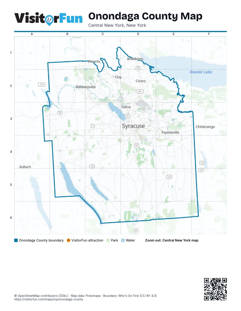
Maps inside Onondaga County
1 map inside, from the street map of Onondaga County down.
Street index of Onondaga County
Each street on the sheet and the grid squares it crosses.
- New York State ThruwayC2, A3, B3, C3, D3, E3
- North West StreetD3
- South West StreetD3
Places on the map
- Anheuser-Busch Brewing Co.
- Arrowhead Golf Course
- Baltimore Woods Nature Center
- Beak & Skiff Apple Farms Inc
- Bellevue Golf and Country Club
- Brewerton
- Burnet Park
- Camillus Forest Unique Area
- Camillus Valley Natural Area
- Carpenters Pond
- Carrier Transicold
- Cavalry Club
- Cicero Swamp Wildlife Management Area
- City of Syracuse
- Clairmont
- Clay Park
- Crooked Lake
- Delphi Quarry
- Destiny USA Mall
- DeWitt
- DeWitt Yard
- Driver's Village
- Drumlins Country Club
- Edgecliff Park
- Erie Village
- Fairmount
- Fayetteville Quarry
- Fayetteville Towne Center
- Forrest Hills
- Fox Fire
- Galeville
- Great Northern Mall
- Green Lake
- Hancock Field
- Highland Forest
- Hinchcliff Family Preserve
- Jamesville Beach County Park
- Jamesville Reservoir
- Jamesville Rock Quarry
Next to Onondaga County
- Auburn
- Chittenango
- Phoenix
© OpenStreetMap contributors (ODbL) · Map data: Protomaps · Boundary: Who's On First (CC-BY 4.0)