

New York map
Schuyler County map
About 17,121 people live here (Census Bureau, 2024 estimate). The sheet's index lists 34 streets; State Route 414, State Highway 224 and State Highway 226 cross the most grid squares. Things to do inside the boundary: Watkins Glen State Park.
Open the map (PDF, US Letter)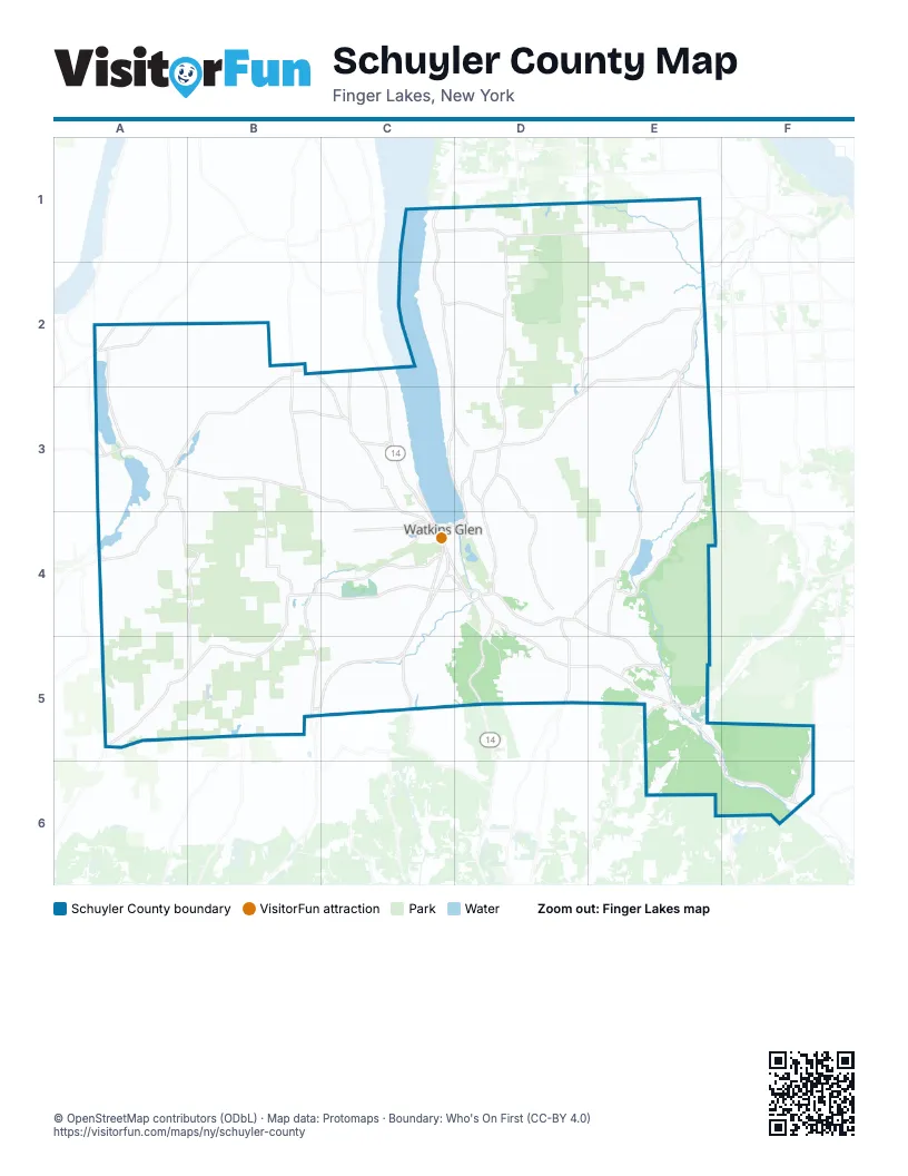
Maps inside Schuyler County
1 map inside, from the street map of Schuyler County down.
Street index of Schuyler County
Each street on the sheet and the grid squares it crosses.
- State Route 414C1, C2, C3, D3, D4
- State Route 230A2
- State Highway 14AB2, C2, C3
- State Highway 226B2, A3, B3, A4
- Mecklenburg RoadE2, D4
- State Highway 227E2
- State Highway 228E2, E3, D4, E4
- State Highway 79E2, D3
- Lake AvenueD3
- Main StreetD3, D4
- Willow StreetD3
- East Fourth StreetC4, D4
- Lake Shore DriveC4
- North Franklin StreetC4
- North Madison AvenueC4
- Old Corning RoadC4
- South Franklin StreetC4, D4
- State Highway 329C4
- State Highway 414C4, B5, C5
- State Route 409C4
- State Route 419C4
- Steuben StreetC4
- Walnut RoadC4
- West Fourth StreetC4
- West Fouth StreetC4
- Catherine StreetD4
- Clawson BoulevardD4
- East Main StreetD4
- North Catherine StreetD4
- South Catherine StreetD4
- State Highway 224D4, E4, E5, F5, F6
- West Main StreetD4
- Elmira RoadE5
- State Highway 13E5
Things to do on the Schuyler County map
Places on the map
- Bad Indian Swamp
- Burdett
- Catharine Creek Wildlife Management Area
- Cayuta Lake
- Cayuta Lake Boat Launch
- Cinnamon Lake
- Cinnamon Lake State Forest
- Cliffside State Forest
- Coon Hollow State Forest
- Farm Sanctuary
- Finger Lakes National Forest
- Fleet Cove
- Goundry Hill State Forest
- Hinman Swamp
- KOA Kampground
- Lamoka Lake
- Martin Nature Preserve
- Mill Pond
- Montour Falls
- Odessa
- Salt Plant
- Schuyler County
- Schuyler Hospital
- Six Nations Campground
- Sugar Hill State Forest
- Teeter Pond
- Texas Hollow State Forest
- Town of Catharine
- Town of Cayuta
- Town of Dix
- Town of Hector
- Town of Montour
- Town of Orange
- Town of Reading
- Town of Tyrone
- Wagner Hardwoods
- Waneta Lake
- Waneta Lamoka Wildlife Management Area
- Watkins Glen
- Watkins Glen Golf Club
© OpenStreetMap contributors (ODbL) · Map data: Protomaps · Boundary: Who's On First (CC-BY 4.0)