

New York map
State Hospital map
A printable two-page map of State Hospital (Buffalo, New York), drawn by VisitorFun from OpenStreetMap. Page two is the street index: every street on the sheet with its grid square, the same list as below.
Open the map (PDF, US Letter)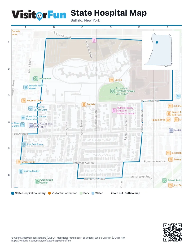
Street index of State Hospital
Each street on the sheet and the grid squares it crosses.
- Ketchum DriveC1, C2
- Richardson RoadD1
- Penhurst PlaceF1
- Bradley StreetB2
- Rees StreetB2, B3
- Hotel Henry WayD2
- Forest AvenueB3, C3, D3, E3
- Hoyt StreetB3, B4, B5, B6
- Parkdale AvenueB3, B4, B5, B6
- Abbotsford PlaceC3, C4
- Baynes StreetC3, C4, C5, C6
- Tremont PlaceD3, D4
- Claremont AvenueE3, E4, E5
- Richmond AvenueE3, E4, D5
- Barry PlaceA4
- Bird AvenueA4, C4, D4, E4
- Grant StreetA5, A6
- Garner AvenueB5
- Manchester PlaceC5, D5, E5
- Greenwood PlaceA6
- Potomac AvenueA6, C6, D6
- Dorchester RoadC6, D6
Places on the map
- Buffalo History Museum - Resource Center
- Buffalo Psychiatric Center
- Burchfield Penney Art Center
- Cucina
- Daniela
- First United Methodist Church of Buffalo
- Forest Automotive
- G&G Mini Mart
- Hotel Henry Way
- Ink Assassins Tattoos & Piercing
- look and see
- Lot R-14
- Lot R-3
- Practice Field
- Richardson Olmsted Complex
- Richardson Olmsted Complex South Lawn
- Rust Belt Books
- The Richardson Hotel
© OpenStreetMap contributors (ODbL) · Map data: Protomaps · Boundary: Who's On First (CC-BY 4.0)