

New York map
Waterfront District map
A printable two-page map of Waterfront District (Buffalo, New York), drawn by VisitorFun from OpenStreetMap. Page two is the street index: every street on the sheet with its grid square, the same list as below.
Open the map (PDF, US Letter)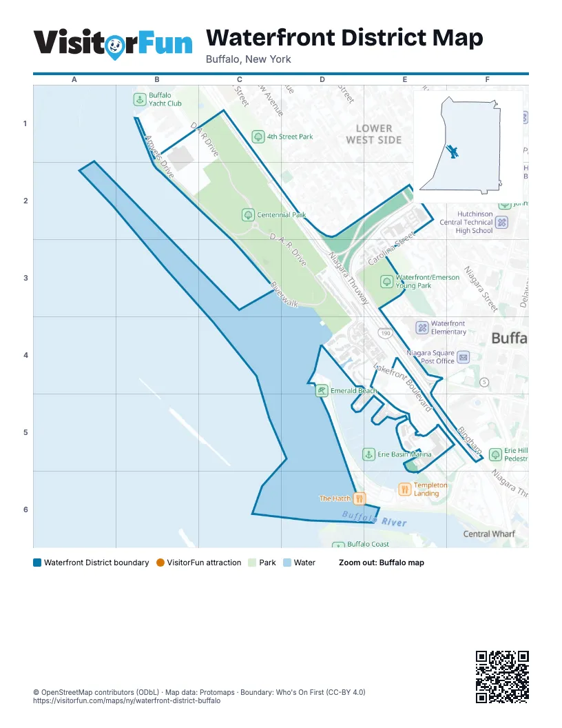
Street index of Waterfront District
Each street on the sheet and the grid squares it crosses.
- Amvets DriveB1, B2, C2
- D A R DriveB1, C1, C2
- Niagara ThruwayC1, C2, D2, D3, E3, E4, E5, F5
- D. A. R. DriveC2, C3, D3
- Efner StreetD2
- Virginia StreetD2, E2
- 7th StreetE2
- Busti AvenueE2, E3
- Carolina StreetE2, D3, E3
- Niagara StreetE2
- 4th StreetD3, E3, E4
- Lakefront BoulevardD3, D4, E4, E5, F5
- Village CourtE3
- Harbour Pointe CommonD4
- Ojibwa CircleE4, E5
- Rivermist Drive NorthE4, D5, E5
- Gull LandingE5
- La Riviere DriveE5, F5, E6
- Rivermist Drive SouthE5
- Waterfront CircleE5
- Erie StreetF5
- Perry BlvdF5
Places on the map
- Buffalo Skate Plaza
- Centennial Park
- Irish Famine Memorial
- La Riviere Drive
- Neighborhood Health Center
- Redwood Village
- Waterfront/Emerson Young Park
Next to Waterfront District
- Buffalo map
- Central Wharf
- Lower West Side map
- Visiting Ship's Dock
© OpenStreetMap contributors (ODbL) · Map data: Protomaps · Boundary: Who's On First (CC-BY 4.0)