

Ohio map
Lake County map
About 232,360 people live here (Census Bureau, 2024 estimate). The sheet's index lists 5 streets; Lakeland Freeway, State Route 44 and I 90 cross the most grid squares. Also on it: Agora Gardens, Beaty Landing and Bellflower Meadows.
Open the map (PDF, US Letter)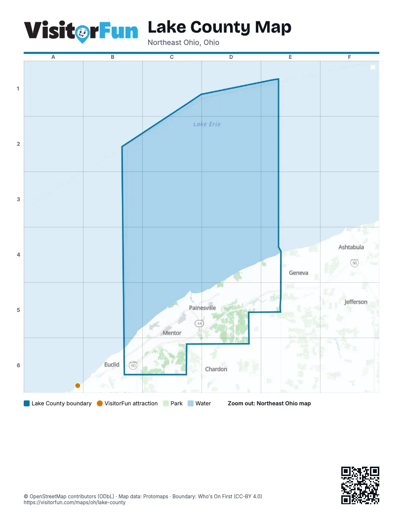
Street index of Lake County
Each street on the sheet and the grid squares it crosses.
- Lakeland FreewayC5, D5, B6, C6
- State Route 44C5, D5
- Euclid SpurB6
- I 90B6, C6
- Outerbelt East FreewayB6
Places on the map
- Agora Gardens
- Beaty Landing
- Bellflower Meadows
- Black Brook Golf Course
- Blair Landing
- Bradenwood
- Brentwood
- Bridle Trail
- Brightwood Lakes
- Cali Woods
- Canyon Ridge
- Carriage Hills
- CEI Northpark Flyash
- Chagrin River Park
- Chapin Forest Reservation
- Chapin Ledges
- Chemical Land Holdings
- Concord Hills
- Concord Township
- Deer Wood Estates
- Deerhaven
- Diamond Shamrock
- Eastlake
- Ellison Creek
- Encore Estates at Heisley Park
- Erie Shores Golf Course
- Fairport Harbor
- Garrett's Cove
- Girdled Road Reservation
- Grand River
- Greenway Corridor
- Gully Brook Park
- Hawthorne Woods
- Heatherstone Village
- Heisley Park
- Helen Hazen Wyman Park
- Hemlock Ridge
- Hidden Lake Metropark
- Hidden Valley Park
- Hidden Village
Next to Lake County
- Ashtabula
- Chardon
- Euclid
- Geneva
- Jefferson
© OpenStreetMap contributors (ODbL) · Map data: Protomaps · Boundary: Who's On First (CC-BY 4.0)