

Pennsylvania map
Montgomery County map
About 879,190 people live here (Census Bureau, 2024 estimate). The sheet's index lists 11 streets; Pennsylvania Turnpike Northeast Extension, Pennsylvania Turnpike and Pottstown Expressway cross the most grid squares. Things to do inside the boundary: Valley Forge Casino Resort.
Open the map (PDF, US Letter)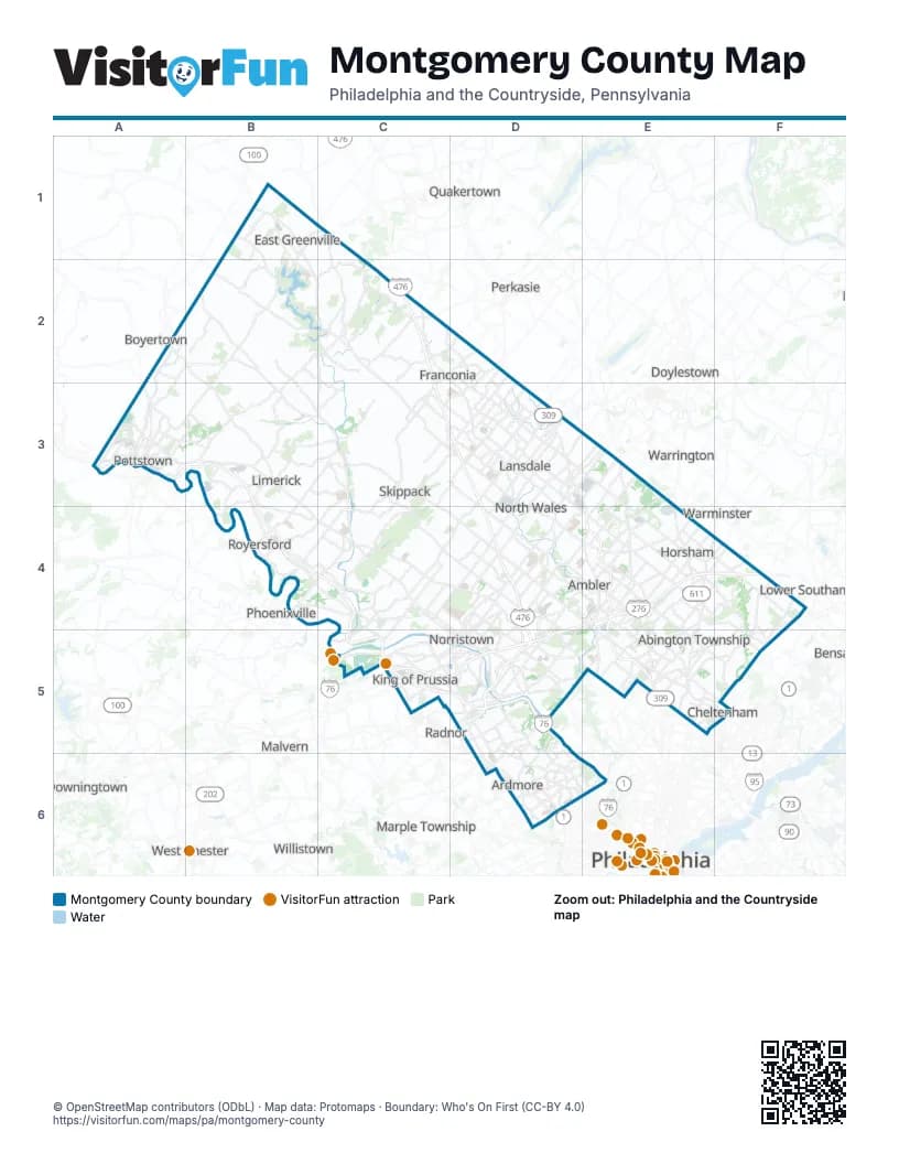
Street index of Montgomery County
Each street on the sheet and the grid squares it crosses.
- Pennsylvania Turnpike Northeast ExtensionC2, C3, D3, D4, D5
- Sellersville BypassD2
- Pottstown BypassA3, B3
- Pottstown PikeA3
- Pottstown ExpresswayB3, B4, C4, C5
- Pennsylvania TurnpikeD4, E4, F4, C5, D5
- Fort Washington ExpresswayE4, E5
- County Line ExpresswayC5
- Schuylkill ExpresswayC5, D5, D6, E6
- Mid-County ExpresswayD5
- Fort Washington Fort Washington ExpresswayE5
Things to do on the Montgomery County map
Places on the map
- Abington Township
- ACTS Normandy Farms Estates
- Alverthorpe Park
- Ambler
- Andorra Woods
- Arcola Corporate Campus
- Ardmore
- Ardsley Wildlife Sanctuary
- Audubon
- Babylon Business Campus
- Bella Vista Golf Course
- Blair Mill Village
- Blue Bell
- Blue Bell Country Club
- Bluestone Country Club
- Boyertown Landfill
- Bradford Woods
- Bridgeport
- Brookside Country Club
- Bryn Athyn
- Bryn Mawr
- Butter Valley Golf Course
- Camp Garrison
- Cedarbrook Country Club
- Central Perkiomen Valley
- Central Perkiomen Valley Park
- Cheltenham Township
- Clemens Food Group
- Collegeville
- Commonwealth Corporate Center
- Conshohocken
- Cranberry Estates
- Deep Creek Lake
- Del Webb North Penn
- Douglass Township
- Eagleville
- East Greenville
- East Norriton Township
- Evansburg
- Evansburg State Park
Next to Montgomery County
- Boyertown
- Camden
- Downingtown
- Doylestown
- Lower Southampton
- Malvern
- Marple Township
- Perkasie
- Philadelphia map
- Phoenixville
- Quakertown
- Radnor
- Spring City
- Upper Providence
- Warminster
- Warrington
- West Chester
- Willistown
© OpenStreetMap contributors (ODbL) · Map data: Protomaps · Boundary: Who's On First (CC-BY 4.0)