

South Carolina road map
Cherokee Foothills Scenic Highway map
The Cherokee Foothills Scenic Highway has been a National Scenic Byway since 1998, named for its scenic qualities: about 118 miles in South Carolina. It meets 19 highways, among them I-26, US 25 and US 76. Towns along it: Gaffney, Walhalla and Campobello.
Open the map (PDF, US Letter)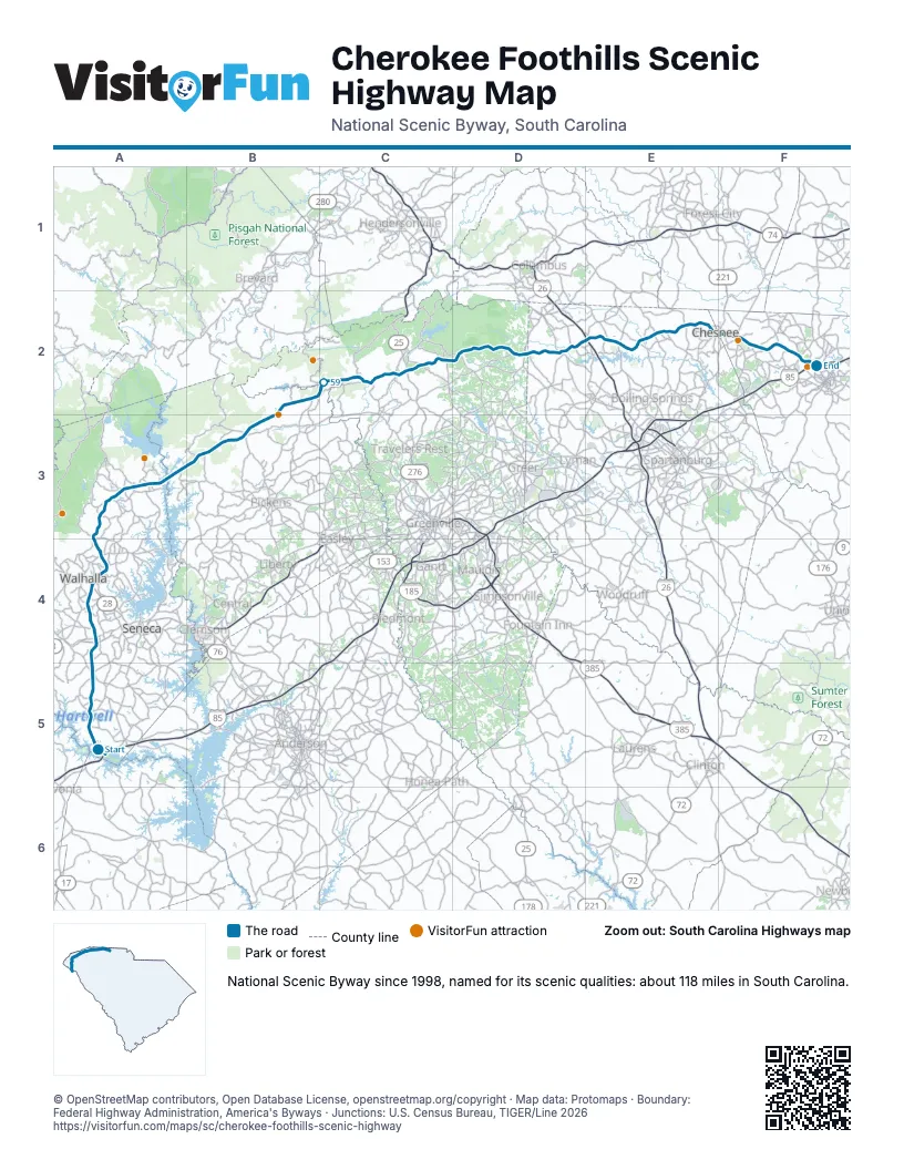
Highways it meets
Each highway it meets and the grid squares where they meet.
- SC 24A5
- US 76A4
- US 123A4
- SC 28A4
- SC 183A4
- SC 11A3
- SC 130A3
- SC 133A3
- US 178B3
- US 276C2
- US 25C2
- SC 101D2
- SC 14D2
- US 176D2
- SC 357D2
- I-26E2
- SC 9E2
- US 221E2
- SC 110F2
Towns along the Cherokee Foothills Scenic Highway
In mile order, with the grid square of each.
- Fair Playmile 0, A5
- Chickasaw Pointmile 3, A5
- South Unionmile 4, A5
- Walhallamile 20, A4
- West Unionmile 20, A4
- Tamasseemile 29, A3
- Salemmile 32, A3
- Campobellomile 86, D2
- Fingervillemile 96, E2
- Chesneemile 105, E2
- Gaffneymile 117, F2
Things to do on the Cherokee Foothills Scenic Highway map
© OpenStreetMap contributors, Open Database License, openstreetmap.org/copyright · Map data: Protomaps · Boundary: Federal Highway Administration, America's Byways · Junctions: U.S. Census Bureau, TIGER/Line 2026