

South Carolina map
Myrtle Beach & Grand Strand map
The sheet's index lists 11 highways; US 17, SC 9 and SC 22 cross the most grid squares. Things to do inside the boundary: Alligator Adventure, Barefoot Landing and Broadway at the Beach. Also on it: Andrews, Carolina Forest and Conway.
Open the map (PDF, US Letter)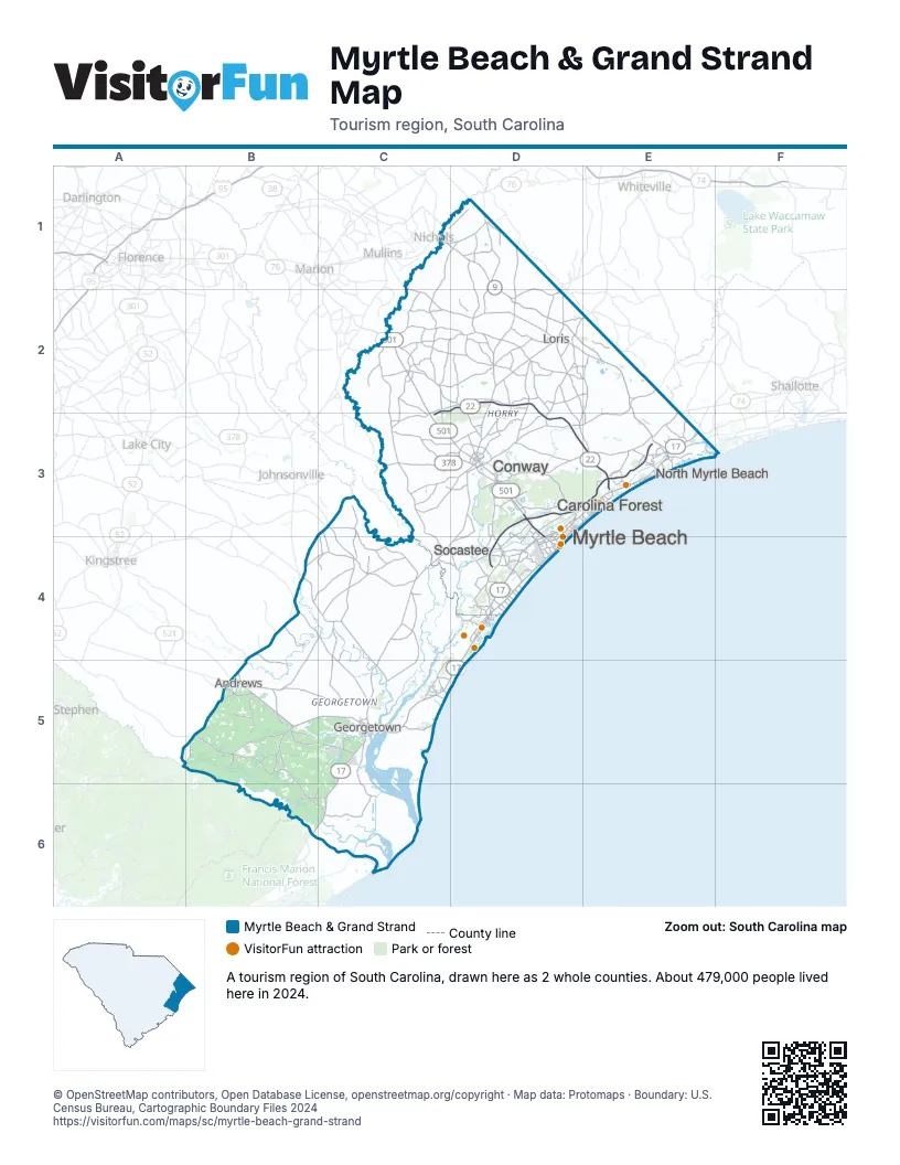
Highway index of Myrtle Beach & Grand Strand
Each highway on the sheet and the grid squares it crosses.
- US 17B5, C5, C6, D3, D4, D5, E3
- US 76C1, D1
- US 378C3, D3
- US 501C2, C3, D3, D4
- US 521B5, C5
- US 701D3
- SC 9C1, D1, D2, E2, E3
- SC 22C2, C3, D2, D3, E3
- SC 31D3, D4, E3
- SC 41B5
- SC 707D4
Things to do on the Myrtle Beach & Grand Strand map
- Alligator Adventure
- Barefoot Landing
- Broadway at the Beach
- Brookgreen Gardens
- Coastal Grand Mall
- Huntington Beach State Park
- Mount Atlanticus Minotaur Golf
- Murrells Inlet MarshWalk
- Myrtle Beach Boardwalk and Promenade
- Pirates Voyage Dinner & Show
- Ripley's Aquarium of Myrtle Beach
- Sea Captain's House
- SkyWheel Myrtle Beach
- Tanger Outlets Myrtle Beach Hwy 501
- WonderWorks Myrtle Beach
Places on the map
- Andrews
- Carolina Forest
- Conway
- Georgetown
- Loris
- Myrtle Beach
- North Myrtle Beach
- Socastee
Next to Myrtle Beach & Grand Strand
- Inner Coastal Plain
- Pinehurst & Sandhills
- Southern Beaches
- Historic Charleston & Resort Islands map
- Pee Dee Country map
- Santee Cooper Country map
© OpenStreetMap contributors, Open Database License, openstreetmap.org/copyright · Map data: Protomaps · Boundary: U.S. Census Bureau, Cartographic Boundary Files 2024