

South Carolina map
Historic Charleston & Resort Islands map
The sheet's index lists 9 highways; US 17, I-26 and I-95 cross the most grid squares. Things to do inside the boundary: Angel Oak, Arthur Ravenel Jr. Bridge and Boone Hall Plantation & Gardens. Also on it: Charleston, James Island and Kiawah Island.
Open the map (PDF, US Letter)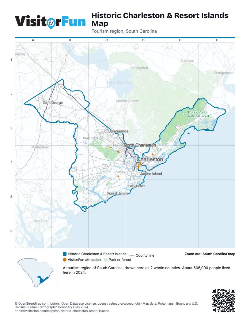
Highway index of Historic Charleston & Resort Islands
Each highway on the sheet and the grid squares it crosses.
- I-26B2, C3, C4, D4
- I-95A2, A3, B2
- I-526C4, D4
- US 17B4, C4, D4, E3, E4, F2, F3
- US 52C3
- US 78C3
- SC 30D4
- SC 162C4
- SC 703D4
Things to do on the Historic Charleston & Resort Islands map
- Angel Oak
- Arthur Ravenel Jr. Bridge
- Boone Hall Plantation & Gardens
- Charles Pinckney National Historic Site
- Charles Towne Landing
- Charleston City Market
- Charleston Museum
- Citadel Mall
- Colonial Dorchester State Historic Site
- Drayton Hall
- Fort Moultrie
- Fort Sumter Visitor Education Center
- Gibbes Museum of Art
- Givhans Ferry State Park
- International African American Museum
- Magnolia Plantation and Gardens
- Middleton Place
- Old Exchange and Provost Dungeon
- Old Slave Mart Museum
- Patriots Point Naval & Maritime Museum
- Rainbow Row
- Sewee Visitor and Environmental Education Center
- South Carolina Aquarium
- The Battery
Places on the map
- Charleston
- James Island
- Kiawah Island
- North Charleston
- Saint George
- Summerville
Next to Historic Charleston & Resort Islands
- Lowcountry & Resort Islands
- Myrtle Beach & Grand Strand map
- Santee Cooper Country map
© OpenStreetMap contributors, Open Database License, openstreetmap.org/copyright · Map data: Protomaps · Boundary: U.S. Census Bureau, Cartographic Boundary Files 2024