

South Carolina map
Richland County map
About 430,651 people live here (Census Bureau, 2024 estimate). The sheet's index lists 3 streets; Charles F Bolden Freeway, William Earle Berne Beltway and I. DeQuincey Newman Freeway cross the most grid squares. Things to do inside the boundary: Congaree National Park, Riverbanks Zoo & Garden and South Carolina State House.
Open the map (PDF, US Letter)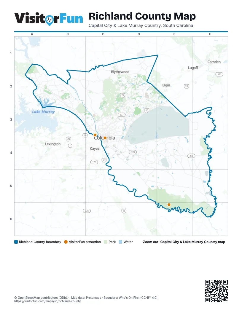
Street index of Richland County
Each street on the sheet and the grid squares it crosses.
- Charles F Bolden FreewayC1, C2, D2, D3
- I. DeQuincey Newman FreewayC3, D3
- William Earle Berne BeltwayD3, C4, D4
Things to do on the Richland County map
Places on the map
- 3 Rivers Greenway
- Arcadia Lakes
- Belfair Oaks
- Blythewood
- Boyds Pond
- Bridge Creek
- Carys Lakes
- CMC Steel
- Cobblestone Park Golf Club
- Columbia
- Columbia Country Club
- Columbia Quarry
- Congaree National Park
- Congaree National Park Wilderness
- Congaree River
- Crafts-Farrow Campus
- Dentsville
- Dreyfus Quarry
- Duffies Pond
- East Lake
- Eastover
- F Coopers Pond
- Five Points
- FN America
- Forest Acres
- Forest Lake
- Forest Lake Club
- Fort Jackson
- Fort Jackson Golf Club
- Haithcock Pond
- Harbison State Forest
- Hilton Field
- Jim Hamilton - L. B. Owens Airport
- Jushi
- Kingston forest
- Lake Carolina
- Lake Columbia
- Lake Katherine
- Lake Murray of Richland
- Linrick Golf Course
Next to Richland County
- Camden
- Cayce
- Elgin
- Lexington
- Lugoff
- West Columbia
© OpenStreetMap contributors (ODbL) · Map data: Protomaps · Boundary: Who's On First (CC-BY 4.0)