

Tennessee map
Shelby County map
About 910,530 people live here (Census Bureau, 2024 estimate). The sheet's index lists 14 streets; Paul W Barret Parkway, Isaac Hayes Memorial Highway and Governor Winfield Dunn Parkway cross the most grid squares. Things to do inside the boundary: Bass Pro Shops at the Pyramid, Beale Street and Graceland.
Open the map (PDF, US Letter)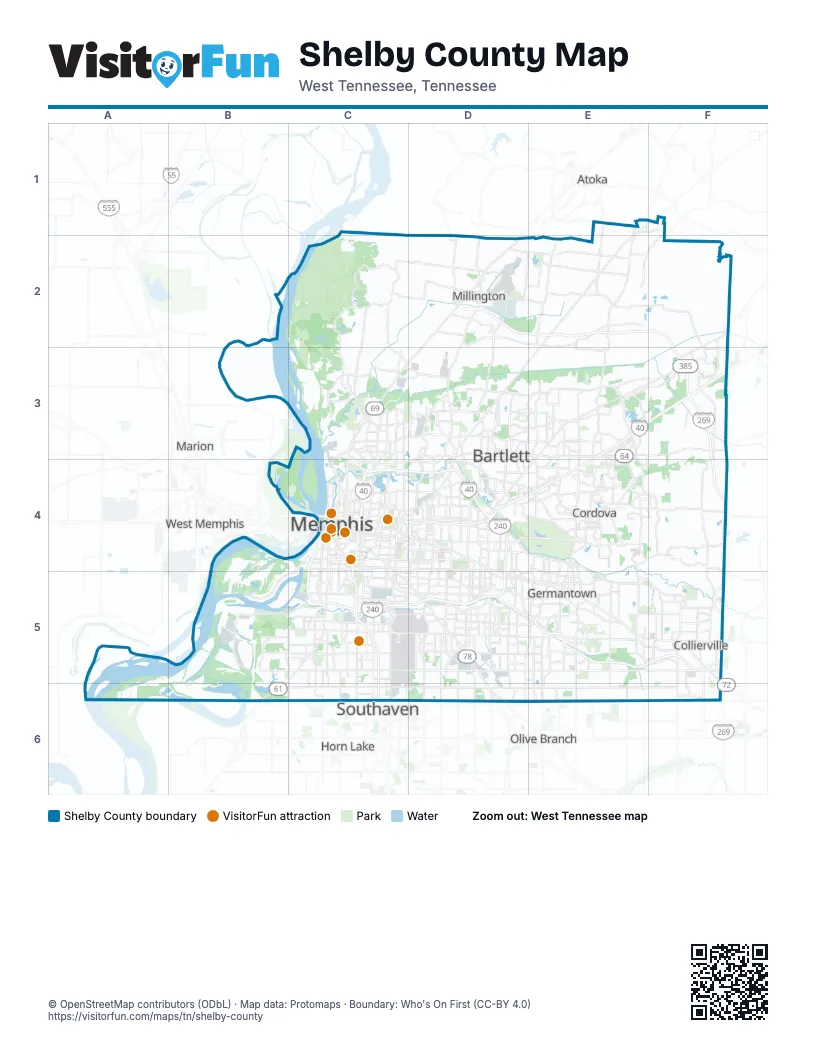
Maps inside Shelby County
1 map inside, from the street map of Shelby County down.
Street index of Shelby County
Each street on the sheet and the grid squares it crosses.
- Paul W Barret ParkwayD2, E2, F2, F3
- Isaac Hayes Memorial HighwayE3, F3, D4, E4
- Governor Winfield Dunn ParkwayF3, F4, F5
- Doctor Martin Luther King Junior ExpresswayC4, D4, C5
- Hernando de Soto BridgeC4
- Memphis-Arkansas Memorial BridgeC4
- North Riverside DriveC4
- The 101 ConnectorC4
- W B Fowler Senior ExpresswayC4, C5
- Avron B Fogelman ExpresswayD4, C5, D5
- Sam Cooper BoulevardD4
- Bishop J O Patterson Senior Memorial ParkwayC5, C6
- Bill Morris ParkwayD5, E5, F5
- Lamar AvenueD6
Things to do on the Shelby County map
Places on the map
- Agricenter International
- Allen Fossil Plant
- Amazon MEM4 Fulfillment Center
- APAC Tennessee
- Arkema
- Arlington
- Audubon Park
- Bartlett
- Bellevue Baptist Church
- Casper Lake
- Chase Lake Number One
- Chucalissa Archaeological Park
- City Brewery
- Cockleburr Lake
- Collierville
- Colonial Country Club
- Colossus 2
- Container Terminal
- Copart Memphis
- Coro Lake
- Dry Bayou
- Ducks Unlimited Park
- Eagle Lake Refuge Wildlife Management Area
- Edmund Orgill Park
- Enstructure Memphis
- Estanaula Trails
- FedEx Hub
- FedEx Loop
- Firestone Park
- Fleming Gardens
- Frayser Recycling
- Frederick W. Smith International Airport
- Garner Lake
- Georgia Pacific Cellulose
- Germantown
- Germantown Greenway
- Glasgow Development
- Gragg Park
- Harrison Yard
- HearthStone
Next to Shelby County
- Atoka
- Horn Lake
- Marion
- Olive Branch
- Southaven
- West Memphis
© OpenStreetMap contributors (ODbL) · Map data: Protomaps · Boundary: Who's On First (CC-BY 4.0)