

Texas map
McLennan County map
About 270,358 people live here (Census Bureau, 2024 estimate). The sheet's index lists 7 streets; Purple Heart Trail, Marlin Highway and South Jack Kultgen Expressway cross the most grid squares. Things to do inside the boundary: Brazos Bluffs Ranch, Brazos Tours and Cameron Park Zoo.
Open the map (PDF, US Letter)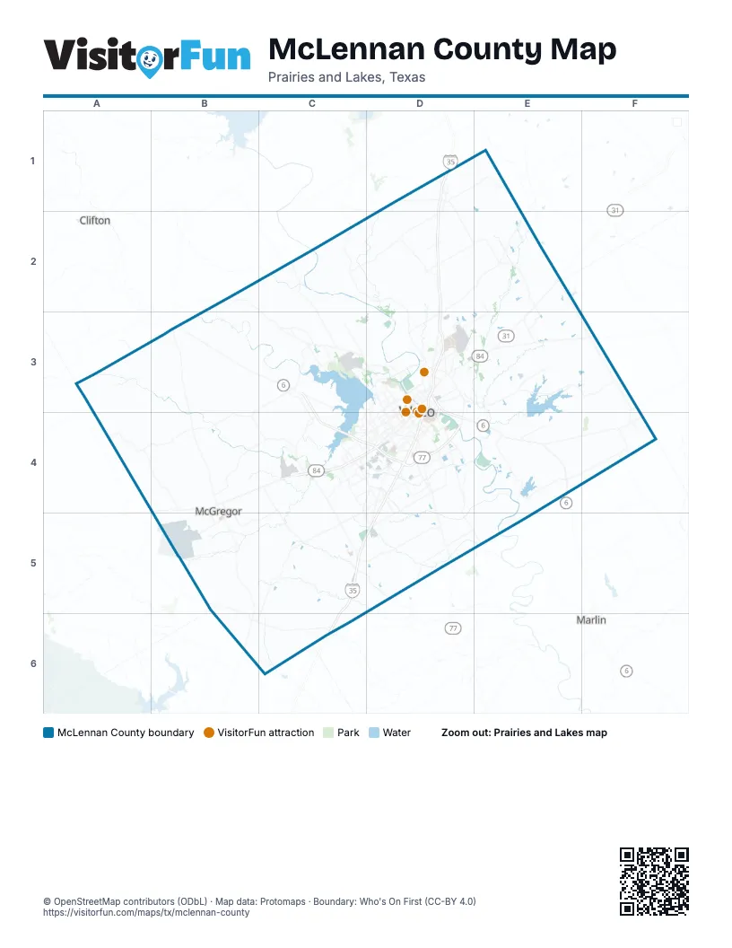
Street index of McLennan County
Each street on the sheet and the grid squares it crosses.
- Purple Heart TrailD1, D2, D3, D4, C5, D5, C6
- Marlin HighwayD3, D4
- North Jack Kultgen ExpresswayD3
- South Jack Kultgen ExpresswayD3, D4
- George W Bush ParkwayC4, D4
- East Loop 340D4
- South Loop DriveD4
Things to do on the McLennan County map
Places on the map
- Airport Park
- Battle Lake Golf Club
- Bear Ridge Golf Course
- Bellmead
- Beverly Hills
- Brazos Park East
- Bruceville-Eddy
- Cameron Park
- Camp Fimfo Waco
- Central Texas MarketPlace
- Chapman Farm
- Cordova Springs
- Cottonwood Creek Golf Course
- Crawford
- Doris Miller VA Medical Center
- Gholson
- Hallsburg
- Hewitt
- Lacy Lakeview
- Lake Creek Lake
- Lake Waco
- Lake Waco Golf Club
- Legacy at Park Meadows
- Leroy
- Lorena
- M Lipsitz & Co
- Mars Wrigley Confectionery
- Mart
- McGregor
- McLennan County
- Moody
- Mount Carmel Center
- New Lake Mart
- Park Meadows
- Reynolds Creek Loop
- Ridgewood Country Club
- Riesel
- Robinson
- Ross
- Speegleville Park
Next to McLennan County
- Clifton
- Marlin
© OpenStreetMap contributors (ODbL) · Map data: Protomaps · Boundary: Who's On First (CC-BY 4.0)