

Utah road map
Dinosaur Diamond Prehistoric Highway map
The Dinosaur Diamond Prehistoric Highway has been a National Scenic Byway since 2002, named for its natural qualities: about 441 miles in Utah and Colorado. It meets 21 highways, among them I-70, US 6 and US 40. Towns along it: Grand Junction, Fruita and Vernal.
Open the map (PDF, US Letter)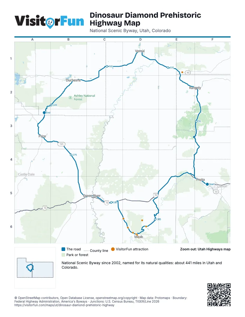
Highways it meets
Each highway it meets and the grid squares where they meet.
- I-70F5
- US 50F5
- US 6F5
- CO 340F5
- CO 139F4
- CO 64F2
- US 40E1
- UT 149D1
- UT 121D1
- US 191D1
- UT 88D1
- UT 87C1
- UT 244A3
- UT 139A3
- UT 55A3
- UT 10A3
- UT 123B4
- UT 19C5
- UT 313D6
- UT 279D6
- UT 128D6
Towns along the Dinosaur Diamond Prehistoric Highway
In mile order, with the grid square of each.
- Grand Junctionmile 0, F5
- Redlandsmile 0, F5
- Fruitamile 4, F5
- Lomamile 10, F5
- Rangelymile 80, F2
- Dinosaurmile 100, E1
- Jensenmile 122, D1
- Naplesmile 131, D1
- Vernalmile 134, D1
- Maesermile 137, D1
- Fort Duchesnemile 159, C1
- Ballardmile 163, C1
- Rooseveltmile 166, C1
- Mytonmile 176, C2
- Duchesnemile 195, B2
- Helpermile 238, A3
- Spring Glenmile 241, A3
- Carbonvillemile 243, A3
- West Woodmile 245, A3
- Pricemile 247, A3
- Wellingtonmile 253, A3
- Green Rivermile 303, B5
- Moabmile 365, D6
Things to do on the Dinosaur Diamond Prehistoric Highway map
© OpenStreetMap contributors, Open Database License, openstreetmap.org/copyright · Map data: Protomaps · Boundary: Federal Highway Administration, America's Byways · Junctions: U.S. Census Bureau, TIGER/Line 2026















