

Virginia map
Chesterfield County map
About 389,793 people live here (Census Bureau, 2024 estimate). The sheet's index lists 9 streets; World War II Veterans Memorial Highway, Powhite Parkway and Chippenham Parkway cross the most grid squares. Also on it: AdvanSix, Amstel Bluff and Apamatica.
Open the map (PDF, US Letter)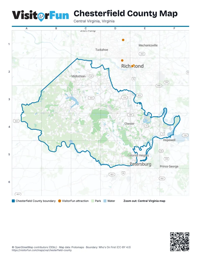
Street index of Chesterfield County
Each street on the sheet and the grid squares it crosses.
- World War II Veterans Memorial HighwayB2, C2, C3, D3, D4, E4
- Powhite ParkwayC2, D2, C3
- Chippenham ParkwayD2, D3, E3
- Pocahontas ParkwayE3
- Richmond-Petersburg TurnpikeE3, E4, E5
- Vietnam War Veterans Memorial BridgeE3
- Frederick T. Gray BridgeE4
- Korean War Veterans Memorial HighwayE4
- Varina-Enon BridgeE4
Places on the map
- AdvanSix
- Amstel Bluff
- Apamatica
- Appomattox River
- Arbor Landing
- Arboretum
- Ashley Forest
- Autumn Oaks
- Beachwood Forest
- Bellwood
- Bensley
- Birkdale Golf Club
- Bon Air
- Boschen Woods
- Boulders Office Park
- Brandermill
- Brandermill Country Club
- Cascade Creek
- Chester
- Chester Linear Park
- Chester Village Green
- Chesterfield County
- Chesterfield Crossing
- Chesterfield Power Station
- Commonwealth Centre
- Craddock Point
- Crestwood Farms
- Dale Quarry
- Defense Supply Center Richmond
- DSC Logistics
- DuPont Spruance Plant
- Dutch Gap Historical Park
- Enon
- Ettrick
- Falling Creek Linear Park
- Falling Creek Reservoir
- Fieldstone
- Five Forks Village
- Forest Lake
- Fox Creek
Next to Chesterfield County
- Colonial Heights
- Highland Springs
- Hopewell
- Mechanicsville
- Petersburg
- Prince George
- Richmond map
- Short Pump
- Tuckahoe
© OpenStreetMap contributors (ODbL) · Map data: Protomaps · Boundary: Who's On First (CC-BY 4.0)