

Virginia map
Harrisonburg Metro Area map
The sheet's index lists 16 highways; US 33, US 11 and I-81 cross the most grid squares. Things to do inside the boundary: Edith J. Carrier Arboretum, Endless Caverns and Hardesty-Higgins House Visitor Center. Also on it: Belmont Estates, Bridgewater and Broadway.
Open the map (PDF, US Letter)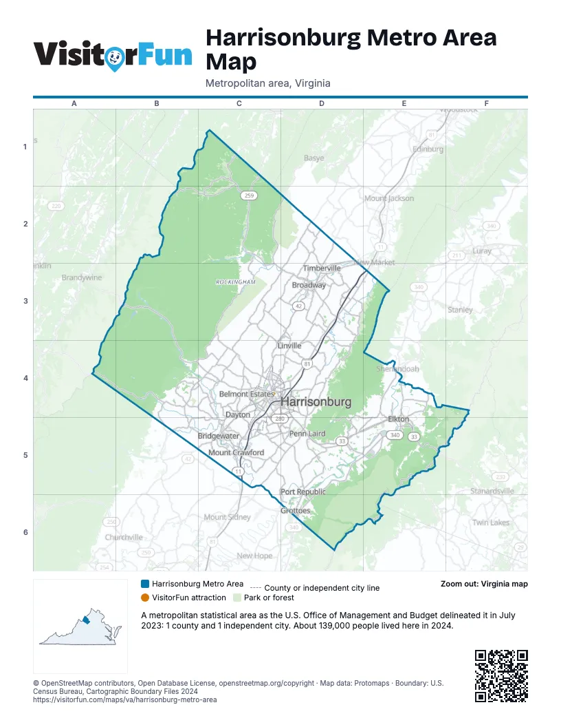
Highway index of Harrisonburg Metro Area
Each highway on the sheet and the grid squares it crosses.
- I-81C4, C5, D3, D4
- US 11C4, C5, D3, D4, E3
- US 33B3, B4, C4, D4, D5, E5
- US 340D5, D6, E4, E5
- VA 42B5, C4, C5, D3
- VA 211D3
- VA 253C4, C5, D5, D6
- VA 256D6
- VA 257C4, C5
- VA 259C1, C2, C3, D3
- WV 259C1
- VA 280C4, C5, D4, D5
- SR 613D3
- SR 655D5
- SR 726C4
- SR 727C5
Things to do on the Harrisonburg Metro Area map
Places on the map
- Belmont Estates
- Bridgewater
- Broadway
- Dayton
- Elkton
- Grottoes
- Harrisonburg
- Linville
- Mount Crawford
- Penn Laird
- Port Republic
- Timberville
© OpenStreetMap contributors, Open Database License, openstreetmap.org/copyright · Map data: Protomaps · Boundary: U.S. Census Bureau, Cartographic Boundary Files 2024