

Wisconsin map
Ephraim map
About 340 people live here (Census Bureau, 2024 estimate). The sheet's index lists 52 streets; State Highway 42, Town Line Drive and North Shore Road cross the most grid squares. Also on it: Anderson Condominiums, Bay Breeze Resort and Bella Vista Lane.
Open the map (PDF, US Letter)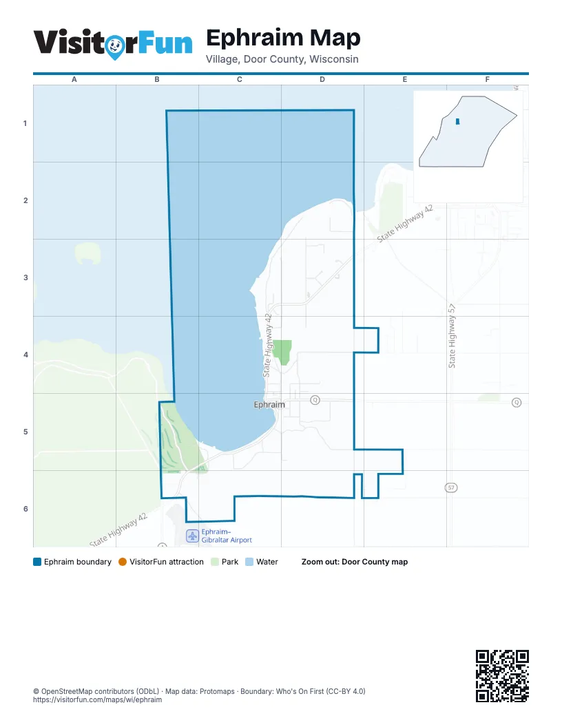
Street index of Ephraim
Each street on the sheet and the grid squares it crosses.
- North Orchard StreetD2, D3
- North Shore RoadD2, C3, D3
- Stock LaneD2
- Town Line DriveD2, D3, D4, D5, D6
- Amundson RoadC3
- Brodd LaneC3
- North Coral Hill RoadC3, D3
- State Highway 42C3, D3, C4, B5, C5, B6
- Bella Vista LaneD3
- Bella Vista Lane SouthD3
- Orchard IsleD3
- Orchard LaneD3
- Shannon LaneD3
- Shannon SquareD3
- South Coral Hill RoadD3, D4
- South Orchard RoadD3, D4
- Anderson LaneC4, D4
- Cedar StreetC4
- Meadow LaneC4, D4
- Moravia StreetC4, D4, C5
- Poplar StreetC4, C5
- Spruce StreetC4, D4
- Cedar LaneD4
- Dane Street NorthD4, D5
- Iverson LaneD4, D5
- Norway Street NorthD4, D5
- Oneson LaneD4
- Settlement RoadD4
- Crystal Springs RoadB5, C5
- Shore RoadB5, B6
- Brookside LaneC5
- Cherry StreetC5
- Church StreetC5, D5
- German RoadC5, D5
- Hidden Spring RoadC5
- Holand RoadC5, B6, C6
- Larson Lane EastC5, D5
- Larson Lane WestC5
- Pioneer LaneC5
- Cherry LaneD5
- County Road QD5
- Dane StreetD5
- Hoganson LaneD5
- Norway StreetD5
- Norway Street SouthD5
- Olson LaneD5
- Smith Lane SouthD5
- Valentine LaneD5
- Willow StreetD5
- Heth RoadB6
- Highland RoadB6
- Maple Grove RoadB6, C6
Places on the map
- Anderson Condominiums
- Bay Breeze Resort
- Bella Vista Lane
- Blue Dolphin House and BDH Studio
- Ephraim
- Ephraim Harbor Condominiums
- Ephraim Historical Foundation
- Ephraim Moravian Church
- Ephraim Nature Preserve at Anderson Pond
- Ephraim Public Library
- Ephraim Shores Resort
- Ephraim Wetlands Preserve
- Ephraim Yacht Club
- Fine Line Designs Gallery
- High Point Inn
- Hillside Waterfront Hotel
- Peninsula State Park Golf Course
- Shannon Lane
- Short Course
- The Water Street Inn
- Village Green Lodge
- Village of Ephraim Public Beach
- Waterbury Inn
Next to Ephraim
© OpenStreetMap contributors (ODbL) · Map data: Protomaps · Boundary: Who's On First (CC-BY 4.0)