

Wisconsin map
Town of Forestville map
About 1,047 people live here (Census Bureau, 2024 estimate). The sheet's index lists 51 streets; County Road H, State Highway 42 and County Road S cross the most grid squares. Also on it: Door County Park, Forestville Flowage and Saint Mary Cemetery.
Open the map (PDF, US Letter)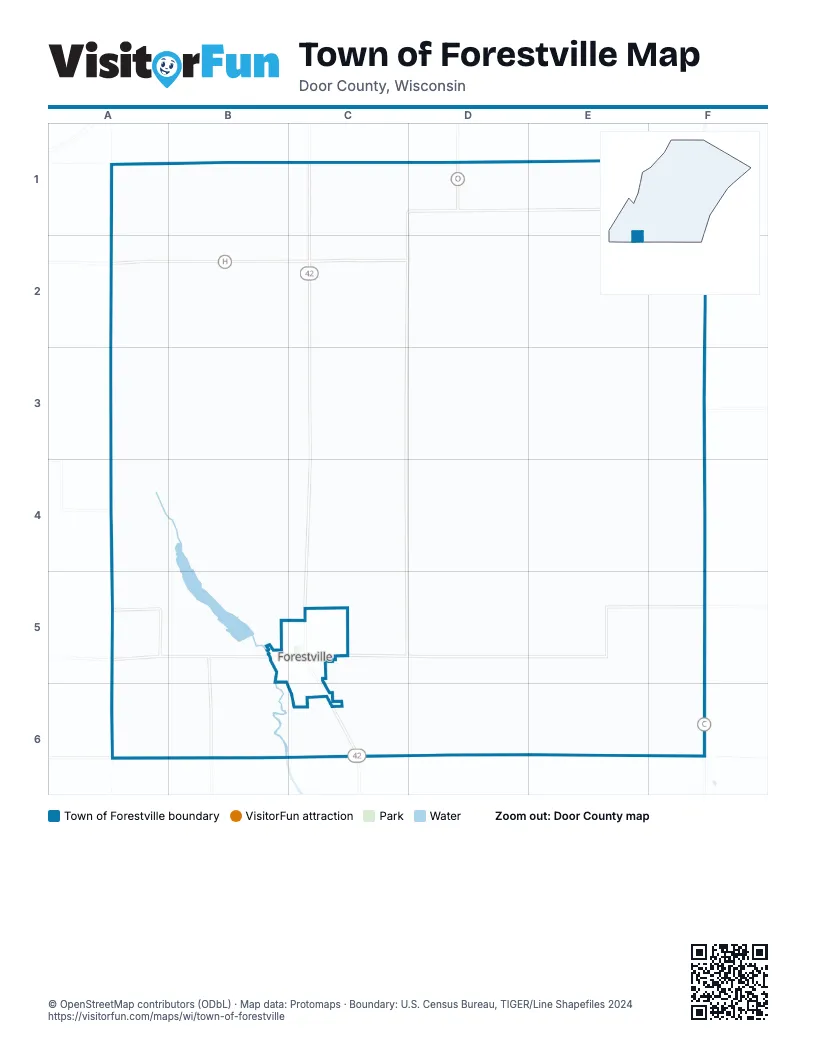
Street index of Town of Forestville
Each street on the sheet and the grid squares it crosses.
- Anschutz RoadA1
- School DriveA1, A2
- Mill RoadB1, B2, B3, B4, B5
- Stone RoadB1, B2
- Wegman RoadB1
- County Road HC1, D1, E1, F1, A2, B2, C2
- Idlewild RoadC1, D1
- Neils RoadC1
- State Highway 42C1, C2, C3, C4, C5, C6
- County Road OD1, C2, C3, C4, C5
- Maple RoadE1, E2
- Viste RoadE1, E2
- County Road SF1, F2, F3, F4, F5, F6
- Hornspier RoadF1
- Delsart RoadC2
- Maplewood RoadC2, D2, E2, E3, F3
- Salona RoadE2, F2
- Snyder LaneF2
- Elm RoadA3, B3, C3, D3
- Herbs RoadA3
- Geier RoadC3, D3, E3
- Center RoadD3, E3, F3, A4, B4, C4
- North Carnot RoadE3, E4
- Vignes RoadE3, F3
- County Road OOF3
- County Road DA4, A5, B5, B6
- Forest DriveA4, A5, A6
- Rabbit RoadA4
- Cherry LaneB4, C4
- Naze RoadB4
- Sleepy Hollow DriveB4, B5
- Carnot RoadC4, D4, E4, F4, E6
- Mile RoadC4
- Walters RoadD4
- Louies RoadE4
- South Carnot RoadE4, E5, E6
- Wilke RoadE4, E5
- County Road JA5, B5, C5, D5, E5, F5
- West Cedar DriveA5, B5
- Leege AvenueB5
- West AvenueB5
- Brans RoadC5
- Delorit DriveC5
- Old Krueger RoadC5, D6
- Old Substation RoadD5, D6
- County Road XB6, C6
- Elder DriveB6
- County Line RoadC6, D6, E6
- Gaede RoadC6
- South Forestville AvenueC6
- Rosewood RoadE6, F6
Places on the map
- Door County Park
- Forestville Flowage
- Saint Mary Cemetery
- Town of Forestville
Next to Town of Forestville
© OpenStreetMap contributors (ODbL) · Map data: Protomaps · Boundary: U.S. Census Bureau, TIGER/Line Shapefiles 2024