

West Virginia road map
Coal Heritage Trail map
The Coal Heritage Trail has been a National Scenic Byway since 1998, named for its historic qualities: about 150 miles in West Virginia. It meets 14 highways, among them I-64, I-77 and US 19. Towns along it: Beckley, Bluefield and Oak Hill.
Open the map (PDF, US Letter)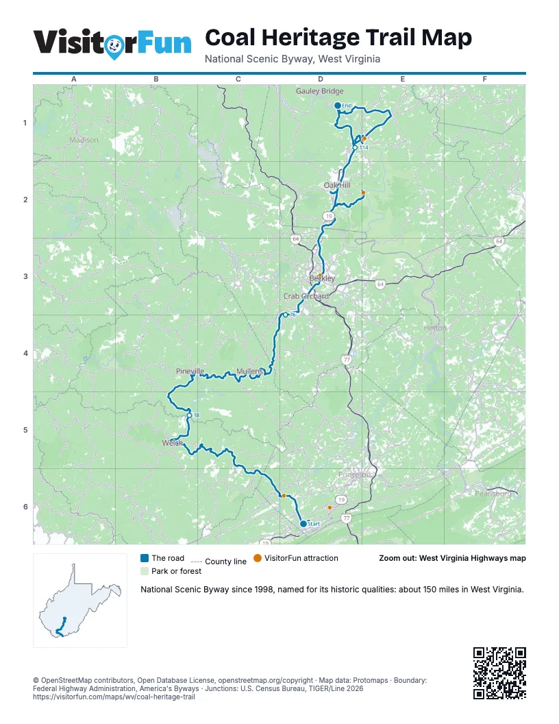
Highways it meets
Each highway it meets and the grid squares where they meet.
- US 52D6
- US 19D6
- WV 123D6
- WV 20D6
- WV 16B5
- WV 10C4
- WV 54D3
- WV 121D3
- I-64D3
- I-77D3
- WV 3D3
- WV 210D3
- WV 61D2
- US 60E1
Towns along the Coal Heritage Trail
In mile order, with the grid square of each.
- Bluefieldmile 0, D6
- Brush Forkmile 1, D6
- Bluewellmile 4, D6
- Bramwellmile 8, D6
- Maybeurymile 14, C6
- Northforkmile 21, C5
- Vivianmile 26, C5
- Kimballmile 28, C5
- Welchmile 29, B5
- Pinevillemile 49, B4
- New Richmondmile 52, C4
- Itmannmile 57, C4
- Mullensmile 59, C4
- Rhodellmile 67, C4
- Helenmile 69, C4
- Sophiamile 78, D3
- Crab Orchardmile 81, D3
- MacArthurmile 83, D3
- Mabscottmile 84, D3
- Beckleymile 85, D3
- Spraguemile 87, D3
- Prosperitymile 91, D3
- Bradleymile 93, D3
- Mount Hopemile 97, D2
- Glen Jeanmile 101, D2
- Hilltopmile 102, D2
- Scarbromile 103, D2
- Oak Hillmile 104, D2
- Fayettevillemile 110, D2
- Hicomile 121, E1
- Anstedmile 127, E1
- Thurmondmile 143, E2
Things to do on the Coal Heritage Trail map
© OpenStreetMap contributors, Open Database License, openstreetmap.org/copyright · Map data: Protomaps · Boundary: Federal Highway Administration, America's Byways · Junctions: U.S. Census Bureau, TIGER/Line 2026