

Alabama map
Tuscaloosa County map
About 241,212 people live here (Census Bureau, 2024 estimate). The sheet's index lists 5 streets; Lurleen B Wallace Boulevard South, McFarland Boulevard and McFarland Boulevard East cross the most grid squares. Also on it: Big Lake, Big Yellow Creek and Bristol Park.
Open the map (PDF, US Letter)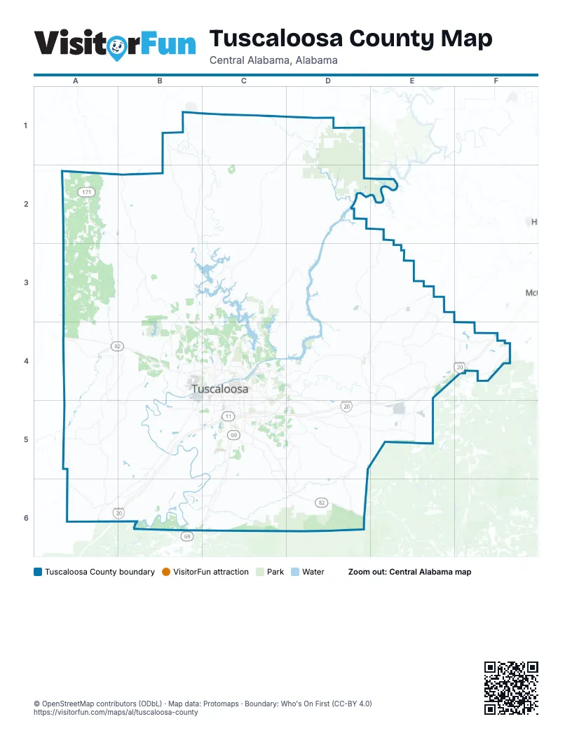
Street index of Tuscaloosa County
Each street on the sheet and the grid squares it crosses.
- Lurleen B Wallace Boulevard SouthC4
- McFarland BoulevardC4
- McFarland Boulevard EastC4
- McFarland Boulevard NortheastC4
- Joe Mallisham ParkwayB5
Places on the map
- Big Lake
- Big Yellow Creek
- Bristol Park
- Brookwood
- Coaling
- Coker
- Cottondale
- Englewood Swamp
- Forest Glen
- Harris Lake
- Harry Pritchett Running Park
- Hidden Meadows
- Hidden Meadows Golf Course
- Holt
- Holt Lake
- Huntington Place
- Hurricane Creek Park
- Indian Hills Golf Course
- J Oviatt Bowers Park
- Lake Lurleen
- Lake Lurleen State Park
- Lake Nicol
- Lake Tamaha
- Lake Tuscaloosa
- Lake View
- Lake Warner
- Mercedes-Benz
- Mimosa Lake
- Moundville Archaeological Park;Mound State Monument
- Mulberry Fork Wildlife Management Area
- Munny Sokol Park
- Northport
- Northport River Walk
- NorthRiver Yacht Club
- Northwood Lake
- Nucor Steel Tuscaloosa
- Ol' Colony Golf Complex
- Parker-Haun Park
- Reed Swamp
- Rock Quarry Park
© OpenStreetMap contributors (ODbL) · Map data: Protomaps · Boundary: Who's On First (CC-BY 4.0)