

Arkansas map
Benton County map
About 321,566 people live here (Census Bureau, 2024 estimate). The sheet's index lists 3 streets; Bella Vista Bypass, Springdale Northern Bypass and XNA Access Road cross the most grid squares. Things to do inside the boundary: Crystal Bridges Museum of American Art, Scott Family Amazeum and The Walmart Museum.
Open the map (PDF, US Letter)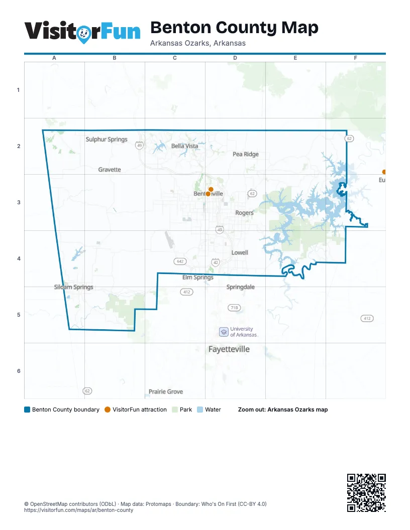
Street index of Benton County
Each street on the sheet and the grid squares it crosses.
- Bella Vista BypassB2, C2, D2, C3
- Springdale Northern BypassC4, D4
- XNA Access RoadC4
Things to do on the Benton County map
Places on the map
- Avoca
- Avoca Quarry & Plant
- Bashore Ridge Loop
- Beaver Lake
- Bella Vista
- Bella Vista Park
- Benton County
- Bentonville
- Bethel Heights
- Big Sugar Golf Club
- Cave Springs
- Centerton
- Coler MTB Park
- Crystal Lake
- Decatur
- Dogwood Golf Course
- Flint Creek Power Plant
- Garfield
- Gateway
- Gentry
- Gravette
- Handcut Hollow MTB Park
- Hickory Creek Park
- Highfill
- Highlands Golf Course
- Hobbs State Park Conservation Area
- Lake Ann
- Lake Atalanta
- Lake Atalanta Park
- Lake Avalon
- Lake Brittany
- Lake Flint Creek
- Lake Norwood
- Lake Rayburn
- Lake Windsor
- Little Flock
- Loch Lomond
- Lost Bridge Trail
- Lost Bridge Village
- Lowell
Next to Benton County
- Elm Springs
- Farmington
- Fayetteville
- Prairie Grove
- Springdale
© OpenStreetMap contributors (ODbL) · Map data: Protomaps · Boundary: Who's On First (CC-BY 4.0)