

Arkansas map
Hot Springs Metro Area map
The sheet's index lists 6 highways; AR 7, US 70 and US 270 cross the most grid squares. Things to do inside the boundary: Bathhouse Row, Buckstaff Bathhouse and Historic Malco Theatre. Also on it: Fountain Lake, Hot Springs and Hot Springs Village.
Open the map (PDF, US Letter)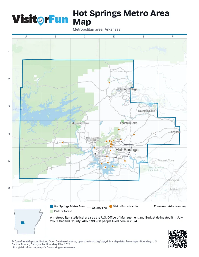
Highway index of Hot Springs Metro Area
Each highway on the sheet and the grid squares it crosses.
- US 70A6, B5, C5, D5, E4, E5, F4
- US 70BC5, D4, D5, E4
- US 270A4, B4, C4, C5, D5, E5
- US 270BC5, D4, D5
- AR 5E4
- AR 7C6, D1, D2, D3, D4, D5, D6, E4
Things to do on the Hot Springs Metro Area map
- Bathhouse Row
- Buckstaff Bathhouse
- Historic Malco Theatre
- Oaklawn Racing Casino Resort
- A Narrow Escape
- Adventureworks
- Arkansas Alligator Farm & Petting Zoo
- Crystal Ridge Distillery
- Dryden Pottery
- Fox Pass Pottery
- Funtrackers Family Fun Park
- Garvan Woodland Gardens
- Hot Springs Gallery Walk
- Hot Springs Marina
- Hot Springs Mountain Tower
- Hot Springs National Park
- Hot Springs Off-Road Park
- Hot Springs Trolleys
- It's About Rocks
- Machine Gun Grotto
- Magic Springs Theme and Water Park
- National Park Duck Tours
- Retroverse Museum
- Ron Coleman Mining
- The Golf Shack
- The Purple Cow
- The Winery of Hot Springs
- TNT Fun Play
- Wake Zone
Places on the map
- Fountain Lake
- Hot Springs
- Hot Springs Village
- Lonsdale
- Mountain Pine
© OpenStreetMap contributors, Open Database License, openstreetmap.org/copyright · Map data: Protomaps · Boundary: U.S. Census Bureau, Cartographic Boundary Files 2024















