

Arizona map
Maricopa County map
About 4,673,096 people live here (Census Bureau, 2024 estimate). Things to do inside the boundary: Arizona Heritage Center at Papago Park, Arizona Office of Tourism and Arizona Outdoor Fun. Also on it: Anthem Golf & Country Club, Area A and Arlington Wildlife Area.
Open the map (PDF, US Letter)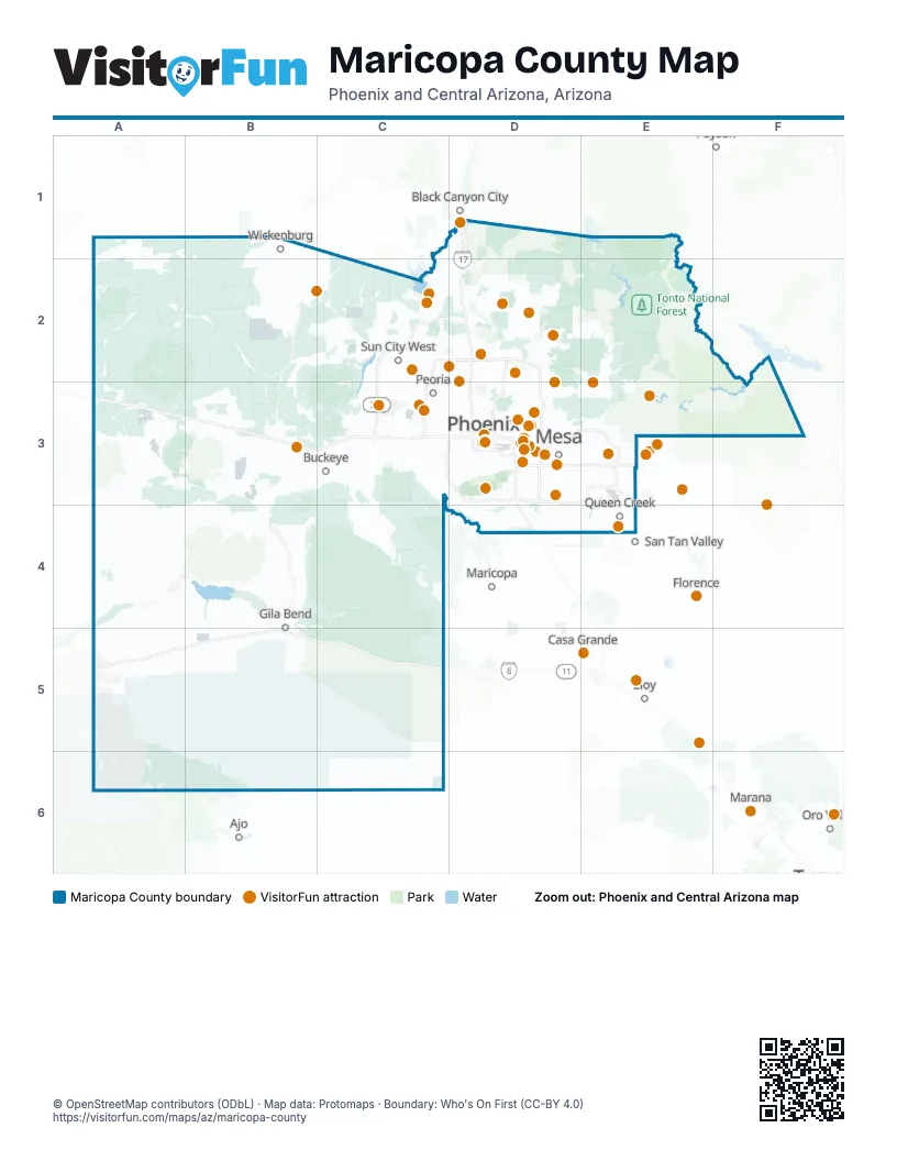
Maps inside Maricopa County
6 maps inside, from the street map of Maricopa County down.
Town
Things to do on the Maricopa County map
- Arizona Heritage Center at Papago Park
- Arizona Office of Tourism
- Arizona Outdoor Fun
- Arizona Science Center
- Cave Creek Trail Rides
- Chandler
- Desert Belle Cruises
- Desert Botanical Garden
- Detours American West
- Discover Salt River Visitor Center
- Downtown Phoenix
- Elite Jewelry & Loan
- Fountain Hills
- Glendale
- Golfland Sunsplash
- Hall of Flame Museum of Firefighting
- Heard Museum
- Hot Air Expeditions
- Koli Equestrian Center
- Lake Pleasant Cruises
- MacDonald's Ranch
- Martin Auto Museum
- Mesa Asian District
- Musical Instrument Museum
- OdySea Aquarium
- Orpheum Theatre
- Papago Park (Hole-in-the-Rock)
- Pecan Lake Entertainment
- Phoenix
- Phoenix Zoo
- Pleasant Water Sports
- Rainbow Ryders Hot Air Balloon Rides
- Scottsdale
- Skydive Buckeye
- Stellar Adventures
- Taliesin West
- Tanger Outlets Glendale
- Tempe
- The Duttons
- Wandering Heart Adventures
- Western Spirit: Scottsdale's Museum of the West
- Westside Recreation
- Wildlife World Zoo Aquarium and Safari Park
Places on the map
- Anthem Golf & Country Club
- Area A
- Arlington Wildlife Area
- Bender Springs Public Use Area
- Big Horn Mountains Wilderness
- Buckeye Hills Regional Park
- Buckeye Municipal Airport
- Camelback Golf Club
- Cave Buttes Recreation Area
- Cave Creek Regional Park
- Estrella Mountain Regional Park
- Four Peaks Wilderness
- Grandview Golf Course
- Hassayampa River Preserve
- Hummingbird Springs Wilderness
- Laveen Area Conveyance Channel
- Lower Gila Terraces and Historic Trails Area of Critical Environmental Concern
- Luke Air Force Base
- McDowell Mountain Regional Park
- McDowell Sonoran Preserve
- Mesa Gateway Airport
- Mirabel Golf Club
- North Maricopa Mountains Wilderness
- North Mountain Preserve
- Paloma Regional Preserve
- Phoenix Mountains Preserve
- Phoenix Sky Harbor International Airport
- Powers Butte Wildlife Area
- Reach 11 Recreation Area
- Saddle Mountain Area of Critical Environmental Concern
- Sierra Estrella Wilderness
- Signal Mountain Wilderness
- Skunk Creek Linear Park
- Skyline Regional Park
- Sonoran Desert National Monument
- Sonoran Preserve
- South Maricopa Mountains Wilderness
- South Mountain Preserve
- State Trust Land
- Superstition Wilderness
Next to Maricopa County
- Ajo
- Black Canyon City
- Casa Grande
- Eloy
- Florence
- Marana
- Maricopa
- Oro Valley
- Payson
- San Tan Valley
© OpenStreetMap contributors (ODbL) · Map data: Protomaps · Boundary: Who's On First (CC-BY 4.0)